James Spann: How much longer will the cooler-than-normal August Alabama days last?

RADAR CHECK: Light rain is falling early this morning over parts of Mobile and Baldwin counties, and a few spots over the eastern part of the state. Generally cloudy conditions will continue across Alabama today with scattered showers, most numerous over the eastern and southern counties. A flash flood watch remains in effect for far East and Southeast Alabama, where a few heavier downpours could develop this afternoon.
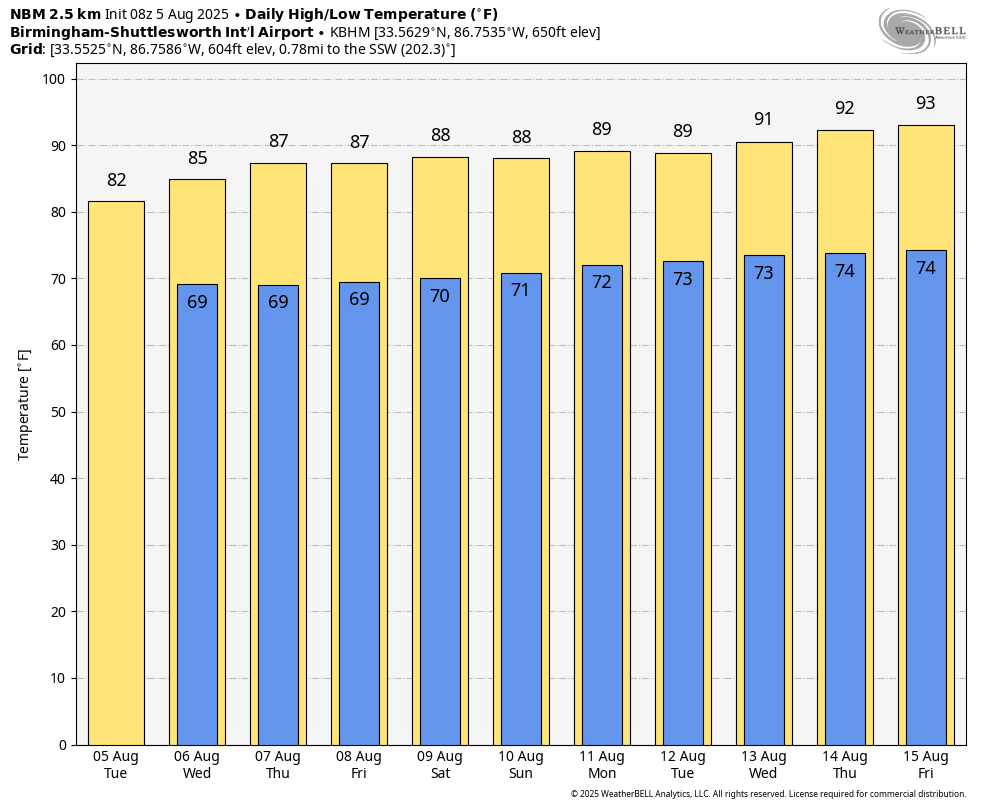
Temperatures remain well below average; highs will be in the 78-84 degree range today for most communities. Heat levels will slowly rise through the week, with some spots reaching 90 degrees by Thursday and Friday. Showers are possible on any summer day in Alabama, but they should be widely scattered over the latter half of the week.
THE ALABAMA WEEKEND: Expect a partly sunny sky Saturday and Sunday with a few random, scattered showers and storms around, mostly during the afternoon and evening hours. Highs will be between 87 and 93 degrees both days for most places.
Heat levels continue to creep up next week, with highs returning to the low to mid 90s over the latter half of the week. A few spotty afternoon showers and storms will be around daily.
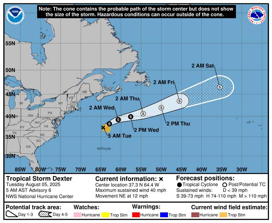
TROPICS: Tropical Storm Dexter is the Atlantic well north of Bermuda, and is disorganized with winds of only 40 mph. It is moving northeast and will become post-tropical by tomorrow night. It is no threat to land.
Elsewhere, a tropical wave over the far eastern tropical Atlantic is currently producing minimal shower activity. Environmental conditions are expected to be conducive for gradual development during the next few days, and a tropical depression could form late this week or over the weekend as the system moves generally west-northwestward across the central tropical or subtropical Atlantic. NHC gives it a 50 percent chance of development; most models suggest this feature will turn north into the open Atlantic.
And, a broad area of low pressure is forecast to develop in a day or two several hundred miles off the coast of the southeastern United States. Some gradual development of this system is possible during the middle or latter portion of this week as the low moves slowly westward to northwestward. Chance of development is 30 percent.
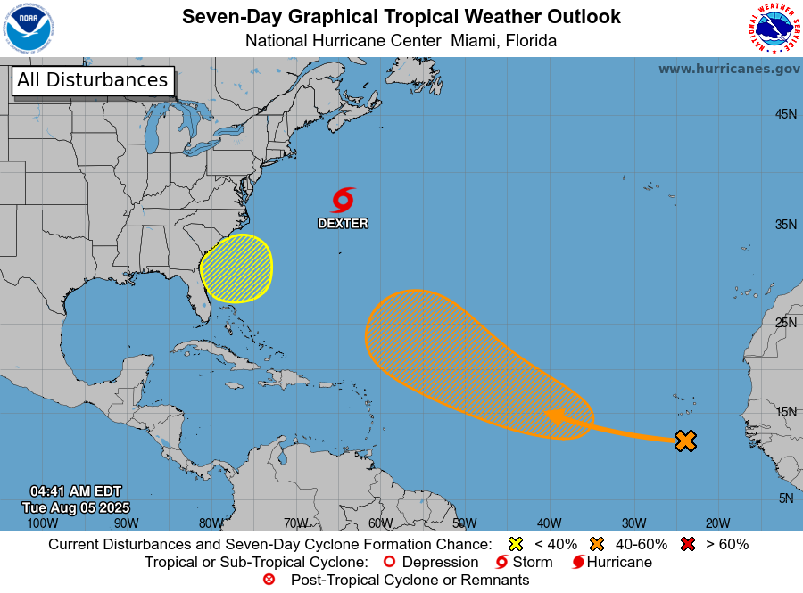
No tropical storms or hurricanes are expected in the Gulf for at least the next seven days.
ON THIS DATE IN 2024: Debby made landfall in the Big Bend region near Steinhatchee as a category one hurricane with winds of 80 mph. It would go on to cause widespread and severe flooding across the Eastern United States and portions of Eastern Canada, becoming the costliest natural disaster in the history of the Canadian province of Quebec. Heavy rainfall was exacerbated by Debby’s slow motion, with accumulations peaking near 20 inches (510 mm) near Sarasota, Florida as of August 7. Two dozen tornadoes were confirmed as the storm also moved up the East Coast of the United States.
For more weather news and information from James Spann and his team, visit AlabamaWx.com.