Bill Murray: More steamy conditions and storms for Alabama

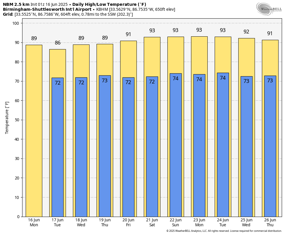
TODAY: I’m standing in for James Spann, who is enjoying a well-deserved vacation. As we roll into the heart of June, the rhythm of the season takes hold across Alabama: hot, humid and stormy. Skies will be partly sunny this morning with storms increasing by early afternoon. The best chance for rain (60-70%) comes between 1 p.m. and 7 p.m., though some early showers can’t be ruled out in the west. Highs will reach the upper 80s. Southwest winds will blow around 5-10 mph. Storms will be capable of torrential downpours, frequent lightning and gusty winds. After sunset, convection will gradually diminish, though some showers may linger. Overnight lows will fall into the lower 70s under mostly cloudy skies.
REST OF THE WEEK: Tuesday and Wednesday will be copy-paste days — mostly sunny mornings giving way to scattered storms in the afternoon. Moist southwest flow will keep us in a very humid pattern. Highs remain in the mid to upper 80s, and rain chances hover around 60-70% both days.
By Thursday, a weak trough associated with a surface low in the Great Lakes region may sweep through the Tennessee Valley, temporarily lowering rain chances by the weekend. Friday and Saturday could be a touch drier with more sun and fewer afternoon storms — though we’ll still keep a 30-40% chance each day. Highs may tick upward into the low 90s by Friday.
SUMMER SOLSTICE: The summer solstice occurs Friday at 9:41 p.m. That marks the official start of astronomical summer and the longest day of the year in terms of daylight. Alabama will enjoy nearly 14½ hours of daylight on Friday — and it will certainly feel like summer.
TROPICS: The National Hurricane Center does not expect any tropical cyclone development over the next seven days in the Atlantic basin. A combination of dry air, Saharan dust and strong upper-level winds is keeping conditions unfavorable for development — but we’re now in the early stages of the Atlantic hurricane season, which runs through Nov. 30.
ON THIS DATE IN 1972: Tropical Storm Agnes formed east of the Yucatán Peninsula. After making landfall along the Florida Panhandle as a minimal hurricane, Agnes took on a second life. Her remnants rejuvenated over the Northeast, dumping torrential rainfall and causing record flooding June 20-24 across Pennsylvania and New York.
For more weather news and information from James Spann, Bill Murray and other members of the James Spann team, visit AlabamaWx.