James Spann: A few showers, storms for Alabama Friday; dry weekend ahead

RADAR CHECK: The large rain mass that was over Alabama this morning has moved on to the east; we have just a few spotty, widely scattered showers on radar at midafternoon. With a mix of sun and clouds, temperatures are only in the 70s over most of the state, a good 10-15 degrees below average for late May.
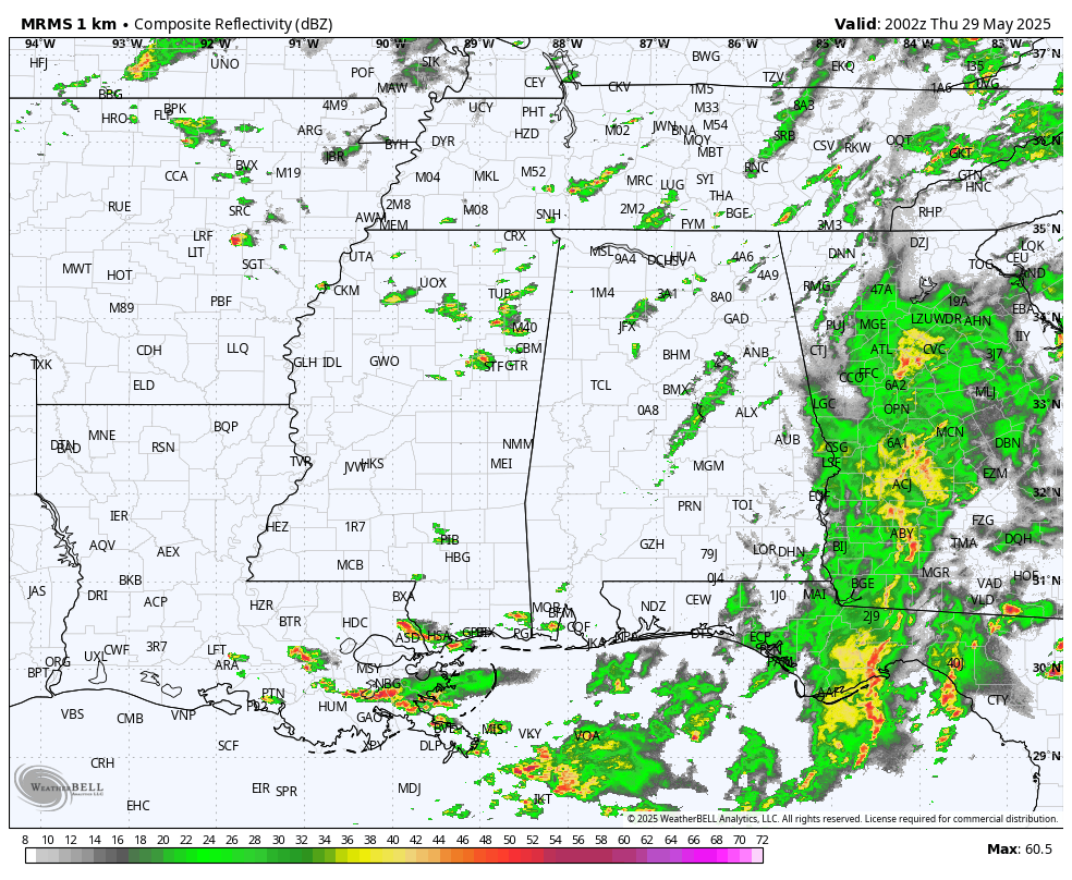
A cold front will push into the Deep South Friday with more showers and storms. The highest coverage of rain for north Alabama will come during the morning; by afternoon, most of the showers and storms will be over the southern half of the state. Like recent days, a few strong storms are possible ahead of the front, with gusty winds and small hail.
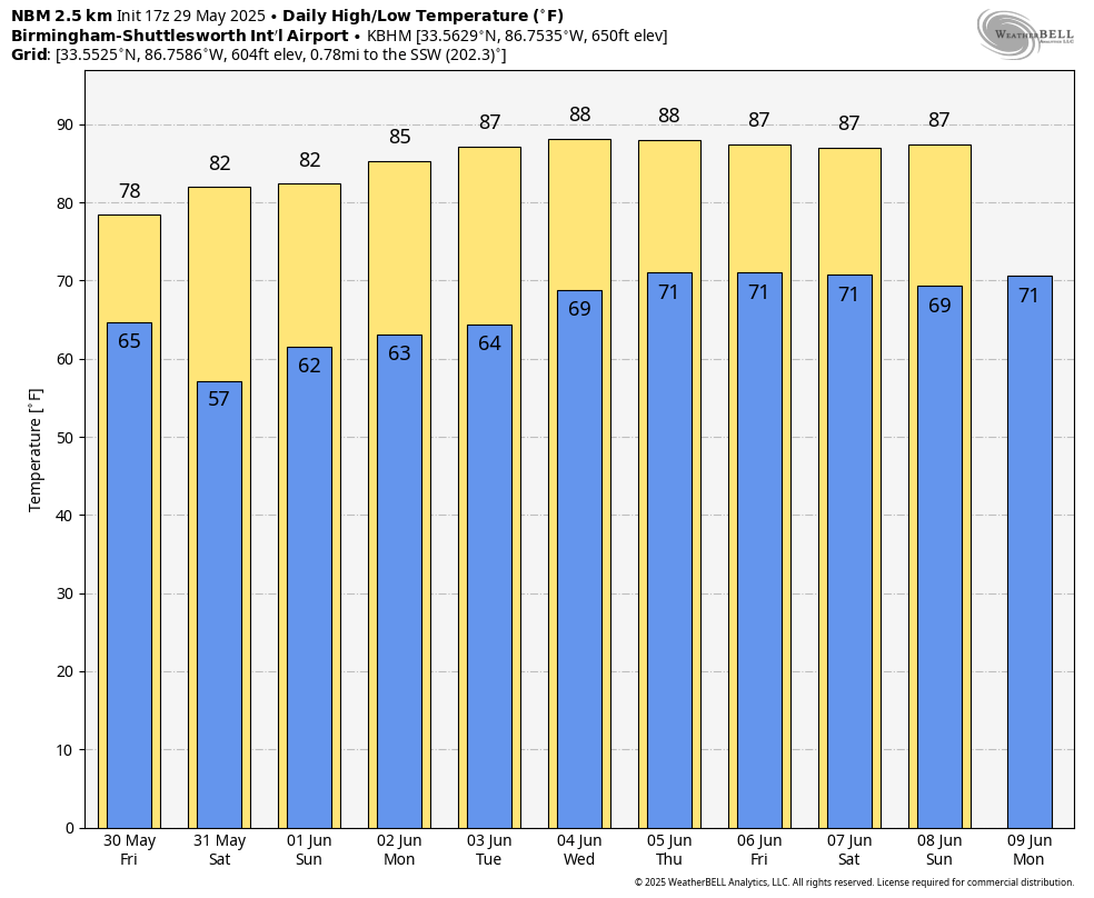
THE ALABAMA WEEKEND: We get a chance to dry out, with mostly sunny weather both days, highs in the low to mid 80s and lower humidity levels. Many north Alabama communities will be in the pleasant 50s early Saturday morning.
NEXT WEEK: An upper ridge will build across the region with rising heat levels; highs most days will be between 85 and 91 degrees. Humidity levels will rise as well, and we will have a few scattered showers and storms, mostly during the afternoon and evening — basically routine early June weather.
ON THIS DATE IN 1982: Two significant tornadoes ripped through southern Illinois. The most severe was an F4 that touched down northeast of Carbondale, then moved to Marion. The twister had multiple vortices within the main funnel. Extensive damage occurred at the Marion Airport. Ten people were killed and 181 were injured.
For more weather news and information from James Spann and his team, visit AlabamaWx.