James Spann: Alabama can expect warm, humid days with a few scattered showers

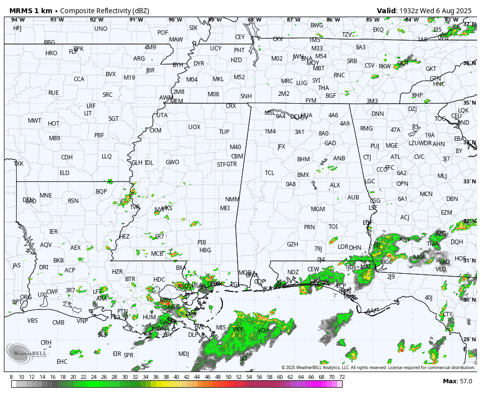
WARMER: Temperatures have returned to the 80s across most of Alabama this afternoon with a mix of sun and clouds. Showers are very isolated; most communities are rain-free.
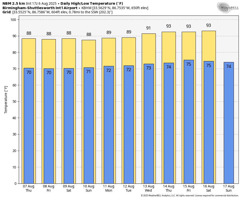
We are forecasting upper 80s for North Alabama, and low 90s for the southern counties tomorrow through Sunday. There is always some risk of showers on a summer day in Alabama, but they should be few and far between. The chance of any one spot seeing rain each day through the weekend is 15-25%, with the higher probabilities over the far southern counties. Expect partly sunny days and mostly fair nights.
NEXT WEEK: The upper ridge begins to rebuild, meaning highs in the 90-95 degree range on most days as summer heat returns to the Deep South. A few spotty showers or storms will be around daily during the afternoon and evening hours … See the video briefing for maps, graphics, and more details.
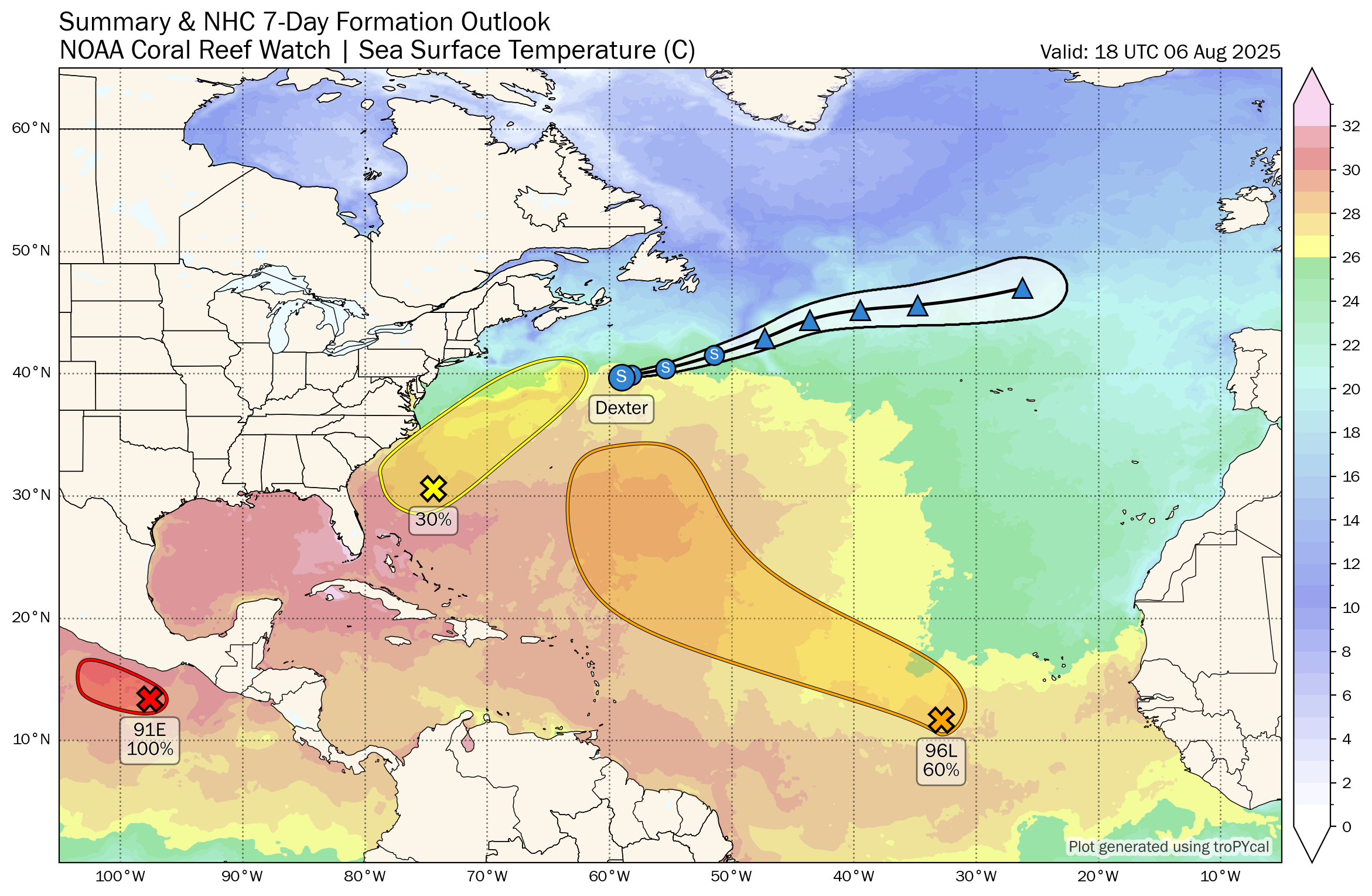
TROPICS: We have three areas of interest this afternoon …
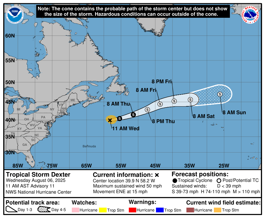
*Tropical Storm Dexter, with winds of 50 mph, is well northeast of Bermuda in the open Atlantic and is moving east/northeast. It becomes post-tropical tomorrow far from land.
*A weak area of low pressure located several hundred miles off the coast of the southeastern United States continues to produce only limited shower and thunderstorm activity. This system is forecast to drift northward over the next day or two before turning northeastward. Environmental conditions now only appear marginally favorable for tropical development into early next week as the system moves northeastward, remaining offshore of the eastern United States.
NHC has dropped the chance of development to 30 percent; this will have no impact on the Deep South or the Gulf.
*Shower and thunderstorm activity has become a bit more concentrated with a tropical wave in the eastern tropical Atlantic (Invest 96L). Environmental conditions are forecast to be conducive for gradual development during the next few days, and a tropical depression could form late this week or over the weekend as the system moves generally west-northwestward to northwestward across the central tropical and subtropical Atlantic. Chance of development is 60%; this feature will turn north into the open Atlantic and is no threat to land.
No tropical storms or hurricanes are expected across the Gulf for at least the next seven days.
ON THIS DATE IN 1959: Hurricane Dot crossed Kauai in the Hawaiian Islands producing sustained winds of 105 mph with gusts to 125 mph. Over 6 inches of rain fell with over 9 inches on the big island of Hawaii. The sugar cane crop on Kauai sustained $2.7 million in damages.
ON THIS DATE IN 1993: Virginia experienced its worst tornado outbreak ever as 18 tornadoes ripped through the state in 5 hours. The most devastating tornado caused severe damage in the historic part of Petersburg. The storm then moved on to Pocahontas Island and into Colonial Heights. There, the storm ripped apart a Walmart store, killing three people and injuring nearly 200. The F4 twister was the first known violent tornado in Virginia history. It killed a total of 4 people and injured 246 along its 12-mile path.
For more weather news and information from James Spann and his team, visit AlabamaWx.com.