James Spann: Alabama could see mid-90s Friday; isolated showers Saturday
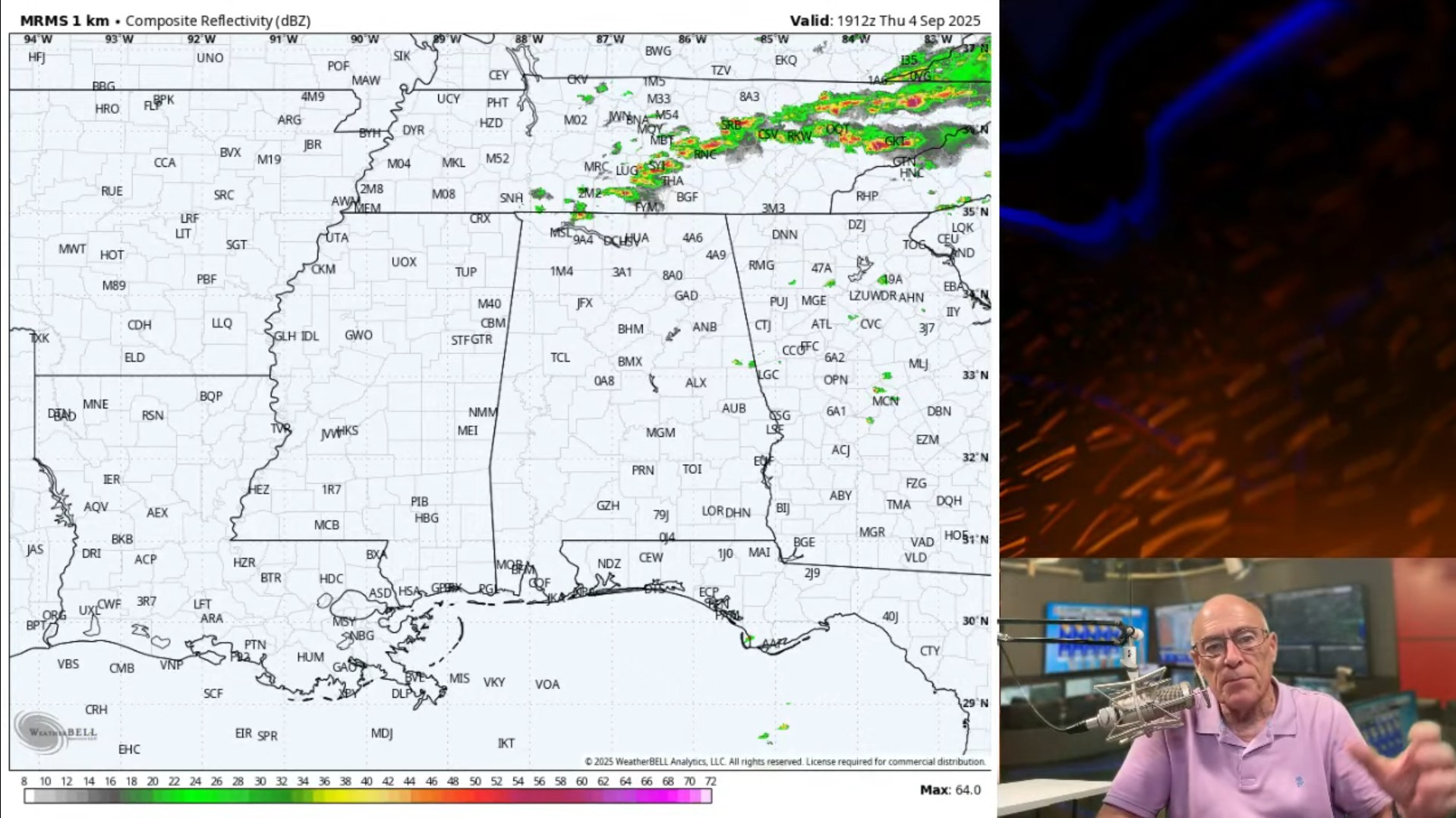
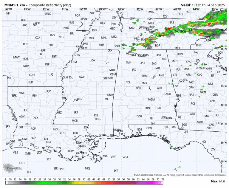
RADAR CHECK: Most of Alabama is dry this afternoon … we note just a few isolated showers and storms near the Tennessee state line. Temperatures are mostly in the upper 80s and low 90s. A few widely scattered showers remain possible this evening across the Tennessee Valley.
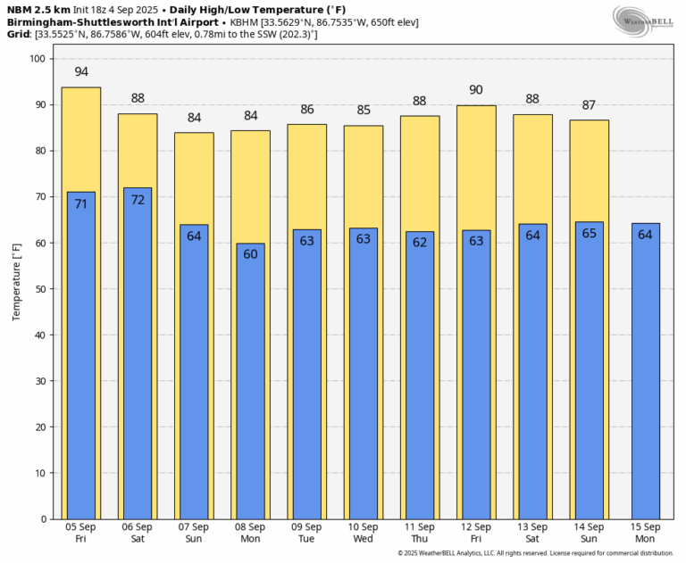
TOMORROW AND THE WEEKEND: A drier airmass drops into Alabama tomorrow; showers should be very isolated. Temperatures rise into the mid 90s tomorrow afternoon, but humidity levels will be lower.
Another front approaches Saturday … this could bring a few showers, but moisture will be limited meaning nothing widespread or heavy. Global models now show another surge of dry air moving into the state Sunday; the day looks generally dry. The high Saturday will be close to 90, followed by low to mid 80s Sunday.
NEXT WEEK: Models have trended toward a drier solution. It now looks like much of next week will be dry with mostly sunny days and fair nights … highs will be in the 80s, lows in the 60s. See the video briefing for maps, graphics, and more details.
TROPICS: A broad area of low pressure has formed along a tropical wave (Invest 91L) over the eastern tropical Atlantic. Recent satellite imagery suggests the system continues to slowly become better organized with shower and thunderstorm activity along its eastern periphery. Environmental conditions are favorable for additional development of the system and a tropical depression is likely to form by this weekend as it moves slowly westward at 5 to 10 mph across the eastern and central tropical Atlantic.
Interests in the Lesser Antilles and Leeward Islands should monitor the progress of this system as it approaches from the east by the middle of next week. NHC gives the system a 90% chance of development, and most global model ensemble members continue to show a turn to the north over the open Atlantic before reaching the U.S.
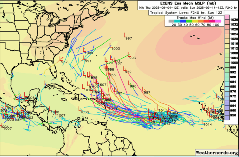
No tropical storms or hurricanes are expected across the Gulf for at least the next 7-10 days.
FOOTBALL WEATHER: Auburn hosts Ball State Saturday evening (6:30 p.m. kickoff) … a brief shower can’t be ruled out during game, otherwise mostly cloudy with temperatures falling from the upper 80s into the upper 70s.
Alabama will host LA-Monroe Saturday evening (6:45 p.m. kickoff) … a shower is possible, otherwise mostly cloudy. Temperatures will fall from near 82 degrees at kickoff into the upper 70s by the fourth quarter.
UAB will play Navy at Annapolis, Maryland Saturday (2:30 p.m. kickoff) … a passing shower or thunderstorm is possible, if not likely during the game. Temperatures will be in the low to mid 80s.
ON THIS DATE IN 2007: Hurricane Felix came ashore in the pre-dawn hours as a Category 5 storm on the northeastern coast of Nicaragua. At the time of its landfall, the maximum sustained surface winds were approximately 160 mph. Felix killed at least 130 people along the coast
ON THIS DATE IN 2011: The center of Tropical Storm Lee moved ashore around sunrise. However, it would be a while before Lee would weaken to a depression as it remained nearly stationary while the southern half of the circulation was over water where it could continue to derive additional energy from the warm ocean. Lee brought torrential rains to Louisiana, Mississippi and Alabama.
For more weather news and information from James Spann and his team, visit the Alabama Weather Network.