James Spann: Alabama sees an increase chance of scattered rain and storms Sunday

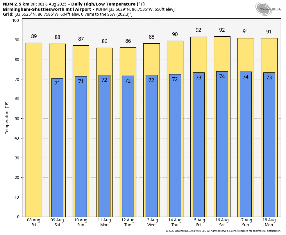
ONLY ISOLATED SHOWERS THROUGH TOMORROW: The chance of any one spot seeing a shower or storm across Alabama today and tomorrow is in the 10-20% range … otherwise expect a partly to mostly sunny sky with highs in the 86-92 degree range. Moisture will be a little deeper, and air a little more unstable Sunday, so the number of scattered showers and storms will likely increase, mostly between noon and midnight. The high Sunday will be in the mid to upper 80s for a decent part of the state.
NEXT WEEK: Warm, humid weather continues through the week with the daily round of scattered showers and storms, most active during the afternoon and evening hours. The chance of any one community seeing rain each day is in the 50-60% range, and highs will be in the 86-92 degree range for much of the week.
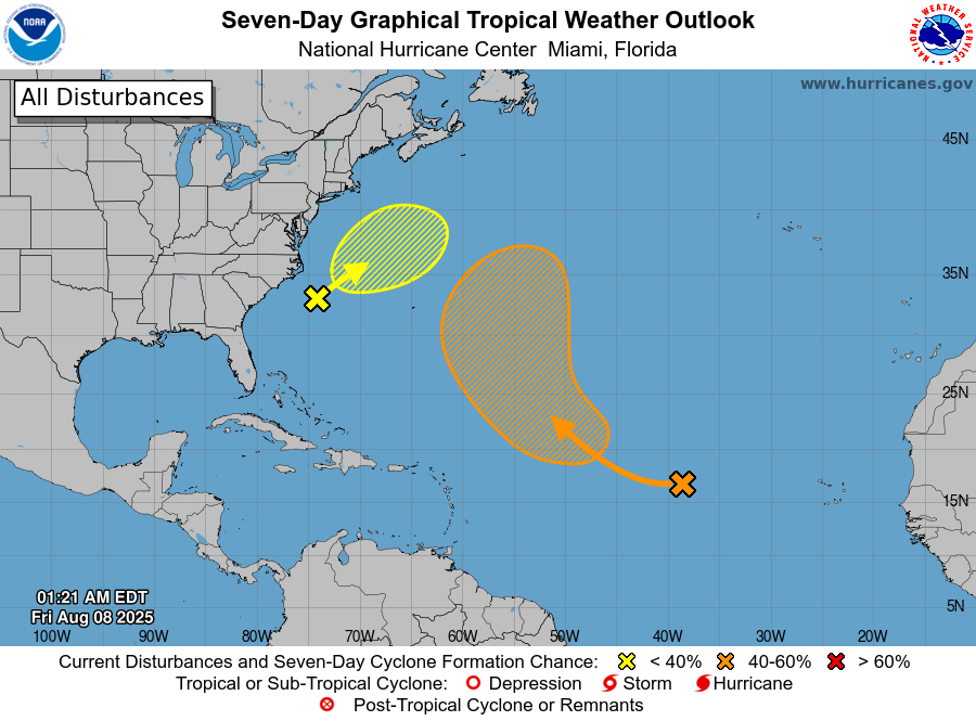
TROPICS: A non-tropical area of low pressure is expected to form in a day or so a few hundred miles offshore of North Carolina. Some tropical or subtropical development is possible this weekend while the system moves northeastward over the warm waters of the Gulf Stream. By early next week, the low is expected to reach colder water and an area of strong upper-level winds, ending its chances for tropical or subtropical development. Chance of development is only 20%, and this is no threat to land.
Also, a tropical wave (Invest 96L) over the central tropical Atlantic continues to produce disorganized shower activity. Development of this system appears unlikely during the next day or two, but environmental conditions are forecast to become more conducive in a few days. A tropical depression could form late this weekend or early next week while the system moves west-northwestward to northwestward across the central tropical and subtropical Atlantic. The chance of development is 60%, but this will turn north into the open Atlantic and is no threat to land.
No tropical storms or hurricanes are expected across the Gulf for at least the next seven days.
ON THIS DATE IN 2007: A tornado bounces across Staten Island and Brooklyn, New York, ripping off roofs and damaging dozens of buildings. The EF-2 twister hop-scotched through Brooklyn’s Bay Ridge and Sunset Park neighborhoods around 6:30 a.m.
For more weather news and information from James Spann and his team, visit AlabamaWx.com.