James Spann: Alabama stays dry Tuesday; a few showers Wednesday through Friday

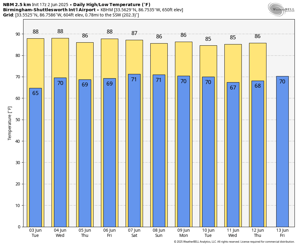
WARM JUNE AFTERNOON: Temperatures are in the mid 80s across most of Alabama this afternoon with a good supply of hazy sunshine. Tonight will be clear with a low in the 60s.
Tuesday will be another warm, dry day. With a mostly sunny sky, temperatures will rise into the 86- to 91-degree range.
SHOWERS RETURN: Moisture levels rise across Alabama over the latter half of the week, and we will introduce some risk of widely scattered showers and thunderstorms Wednesday through Friday. Most of the showers will come during the afternoons and evenings, during the peak of the daytime heating process, and afternoon highs will be mostly in the upper 80s with a mix of sun and clouds — a pretty routine pattern for summer.
THE ALABAMA WEEKEND: A surface front will approach from the north before stalling out over Tennessee. We will mention scattered to numerous showers and thunderstorms Saturday over the northern third of the state, and on Sunday over most of the state, with highs between 85 and 89 degrees. It won’t be a total washout, and the sun will peek out at times. But be ready for a passing shower or storm from time to time.
We will carry some risk of scattered showers and storms in the forecast into the first part of next week with highs holding in the mid to upper 80s.
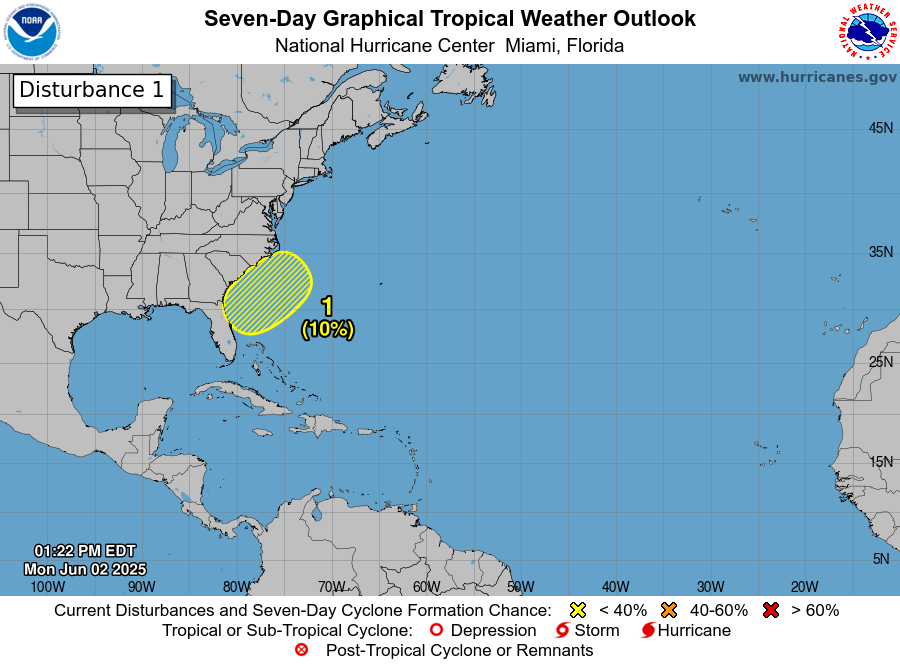
TROPICS: A nontropical area of low pressure is forecast to form near or offshore of the southeastern U.S. coast during the next couple of days. If the system remains offshore, the low could gradually develop some subtropical or tropical characteristics later this week while moving northeastward at 10 to 15 mph. The chance of development over the next seven days is only 10%, and the rest of the Atlantic basin is very quiet.
ON THIS DATE IN 1889: The same storm that caused the historic dam failure in Johnstown, Pennsylvania, also affected Washington, D.C. The streets and reservations in the center of the city and all the wharves and streets along the riverfront were under water. Pennsylvania Avenue was flooded from Second to 10th Streets. The Potomac River crested at the Aqueduct Bridge at 19.5 feet.
ON THIS DATE IN 1998: The first tornado to officially be rated an F4 occurred in Maryland. The storm entered Garrett County, striking the town of Finzel. It then moved up and over Big Savage Mountain in Allegany County and ripped through the northern portion of Frostburg. It reached its peak strength as it crossed the ridge. Winds were estimated between 210 and 250 mph; there were no deaths.
For more weather news and information from James Spann and his team, visit AlabamaWx.