James Spann: Alabama will see a gradual rise in temperatures as seasonal pattern sets in

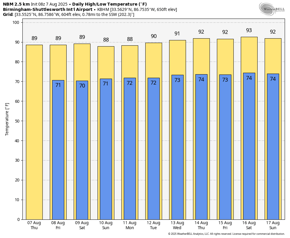
QUIET SUMMER PATTERN: Alabama’s weather won’t change much through Saturday. Partly sunny, warm, humid days with just a few isolated showers around, mostly during the afternoon and evening hours. The chance of any one specific location seeing rain daily is 10-20 percent, mostly during the afternoon and evening hours. Highs will be in the 87-92 degree range for most of the state.
Global models suggest the air will be a little more unstable by Sunday with an increase in the number of scattered showers and thunderstorms, but it still won’t rain everywhere.
NEXT WEEK: A very standard summer pattern sets up across the Deep South. An upper ridge will be in place; expect hot, humid days with the risk of a pop-up afternoon shower or storm daily. Highs will be mostly in the low 90s.
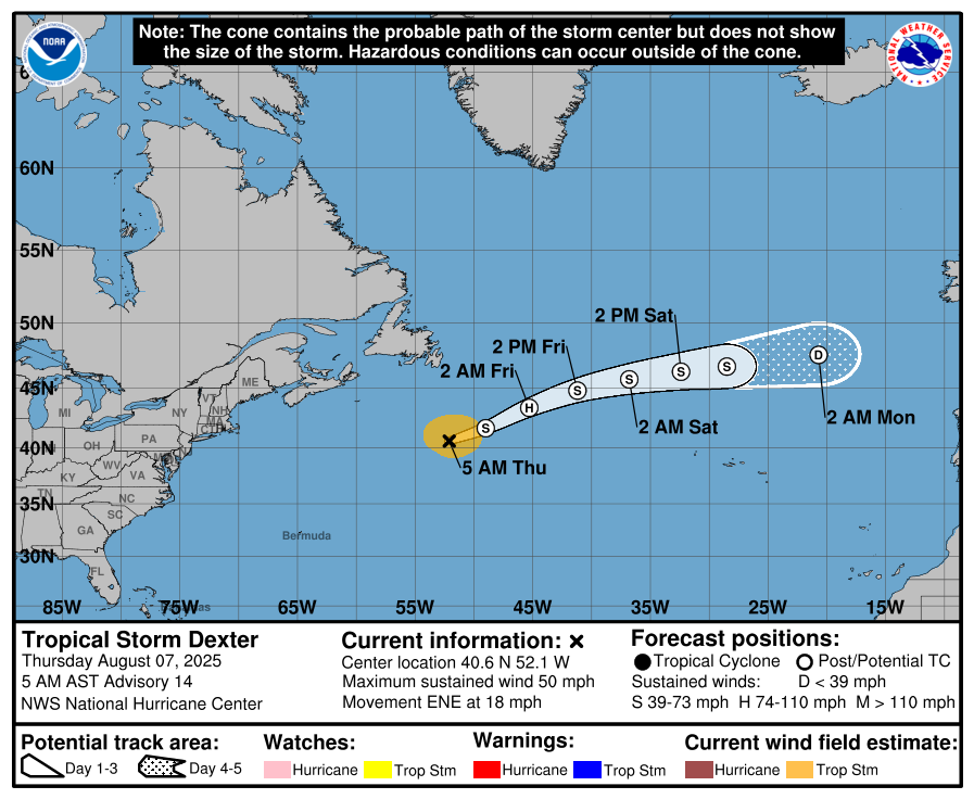
TROPICS: Three areas of interest today …
*Tropical Storm Dexter, in the open Atlantic well east of the U.S. … becomes post tropical today as it moves into a colder environment.
*A weak area of low pressure located a few hundred miles off the coast of the southeastern United States is producing minimal shower and thunderstorm activity. Some slow tropical or subtropical development is possible over the weekend and early next week while the system moves northward to northeastward, remaining well off the east coast of the United States. NHC gives this a 30% chance of development; no threat to land.
*A tropical wave over the eastern tropical Atlantic is producing a large area of disorganized showers and thunderstorms. Environmental conditions are forecast to be generally conducive for gradual development, and a tropical depression could form over the weekend while the system moves west-northwestward to northwestward across the central tropical and subtropical Atlantic. Chance of development is 60% … global models continue to show this feature ultimately turning northward into the open Atlantic; no threat to land.
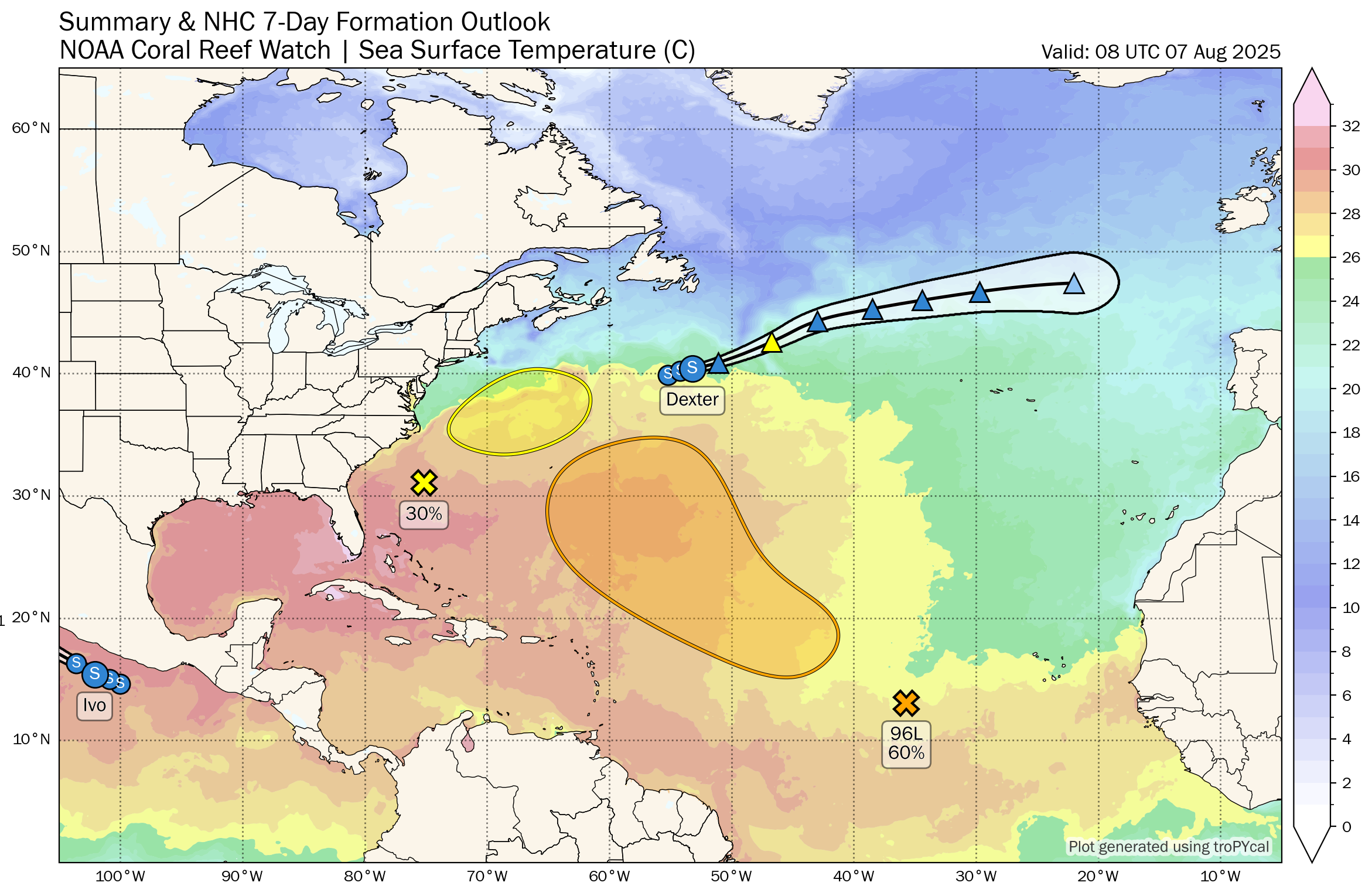
No tropical storms or hurricanes are expected near the Gulf for at least the next 7 days.
ON THIS DATE IN 1924: A tornado caused estimated F4 damage moved southeast from south of Osseo to Black River Falls, Wisconsin. One person was killed as a home was leveled and a boy was killed running to the storm cellar near the start of the path. Two people died as farm homes were swept away near the northeast edge of Black River Falls.
ON THIS DATE IN 1980: Hurricane Allen bottomed out at 899 millibars (26.55 inches of mercury) while moving through the Yucatan Channel in the southeastern part of the Gulf of America. Allen was the second lowest pressure ever recorded in the Western Hemisphere up to that time. Allen’s winds at the time were sustained at 190 mph.
For more weather news and information from James Spann and his team, visit AlabamaWx.com.