James Spann: Alabama’s rain chances increase Tuesday as temperatures stay below average

RADAR CHECK: Scattered showers are most active over the eastern and southern counties of Alabama this afternoon … otherwise we have a mix of sun and clouds with temperatures mostly in the 80s. A few spots over East Alabama are in the upper 70s, over ten degrees below average for mid-August. Showers will remain possible across the state tonight as an upper trough slowly approaches.
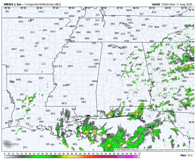
With rising moisture levels and the air becoming more unstable, we expect a continued increase in the number of scattered showers and thunderstorms across Alabama through mid-week. The chance of any one spot seeing rain is 70-80% tomorrow, and 50-60% Wednesday and Thursday. Most, but not all, of the showers will come from around noon to midnight.
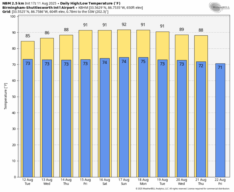
Temperatures will remain generally below average for mid-August. Highs will be in the 85-90 degree range for most communities through Thursday, followed by low 90s Friday, when showers should become fewer in number.
THE WEEKEND: We expect routine summer weather for Alabama and the Deep South over the weekend … partly sunny days with the usual daily rounds of “scattered, mostly afternoon and evening showers and thunderstorms.” Highs will be in the low 90s, right at seasonal averages for August.
The weather won’t change much through next week, although global models suggest highs could drop back into the upper 80s over the latter half of the week. See the video briefing for maps, graphics, and more details.
TROPICS: Tropical Storm Erin has formed in the eastern Atlantic with winds of 45 mph … it is moving to the west at 20 mph.
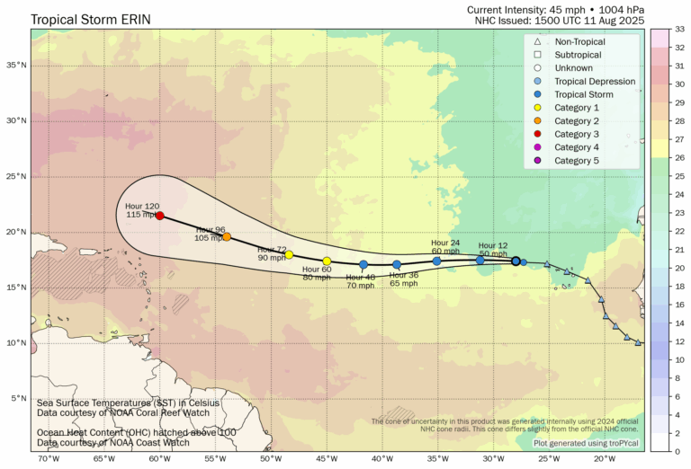
NHC is forecasting Erin to become a major hurricane by Friday night and Saturday as it passes north of the Leeward Islands and Puerto Rico. A weakness in the ridge north of the system will allow for a north turn into the open Atlantic in 6-7 days … this turn should happen well east of the U.S. East Coast.
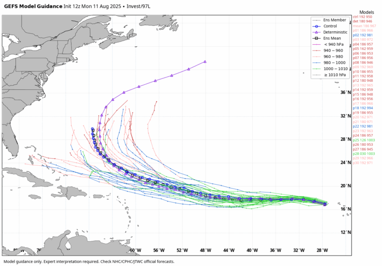
We expect no tropical storms or hurricanes in the Gulf for at least the next seven days.
ON THIS DATE IN 1940: A Category 2 hurricane struck the Georgia and South Carolina coast. A 13-foot storm tide was measured along the South Carolina coast, while over 15 inches of rain fell across northern North Carolina. Significant flooding and landslides struck Georgia, North Carolina, Tennessee and Virginia during the system’s slow trek as a weakening tropical storm, and then as an extratropical cyclone, through the Southeast. The landslides which struck North Carolina were considered a once in a century event. Damages relating to the storm totaled $13 million (1940 USD), and 50 people perished.
ON THIS DATE IN 1999: An F2 tornado touched down in the metropolitan area of Salt Lake City. The tornado lasted 10 minutes and killed one person, injured more than 80 people and caused more than $170 million in damages. It was the most destructive tornado in Utah’s history and awakened the entire state’s population to the fact that the Beehive State does experience tornadoes.
For more weather news and information from James Spann and his team, visit the Alabama Weather Network.