James Spann: Cold front passes through Alabama today; dry air arrives tonight, Saturday

RADAR CHECK: Most of Alabama is rain-free at daybreak with only a few isolated, light showers near the Tennessee state line. But later we expect a line of showers and a few thunderstorms to form along a cold front that will be passing southward through the state today. The best chance of rain will be over the northern counties this morning, shifting into south Alabama this afternoon. A few storms could be strong with gusty winds, but the overall severe weather risk is low.
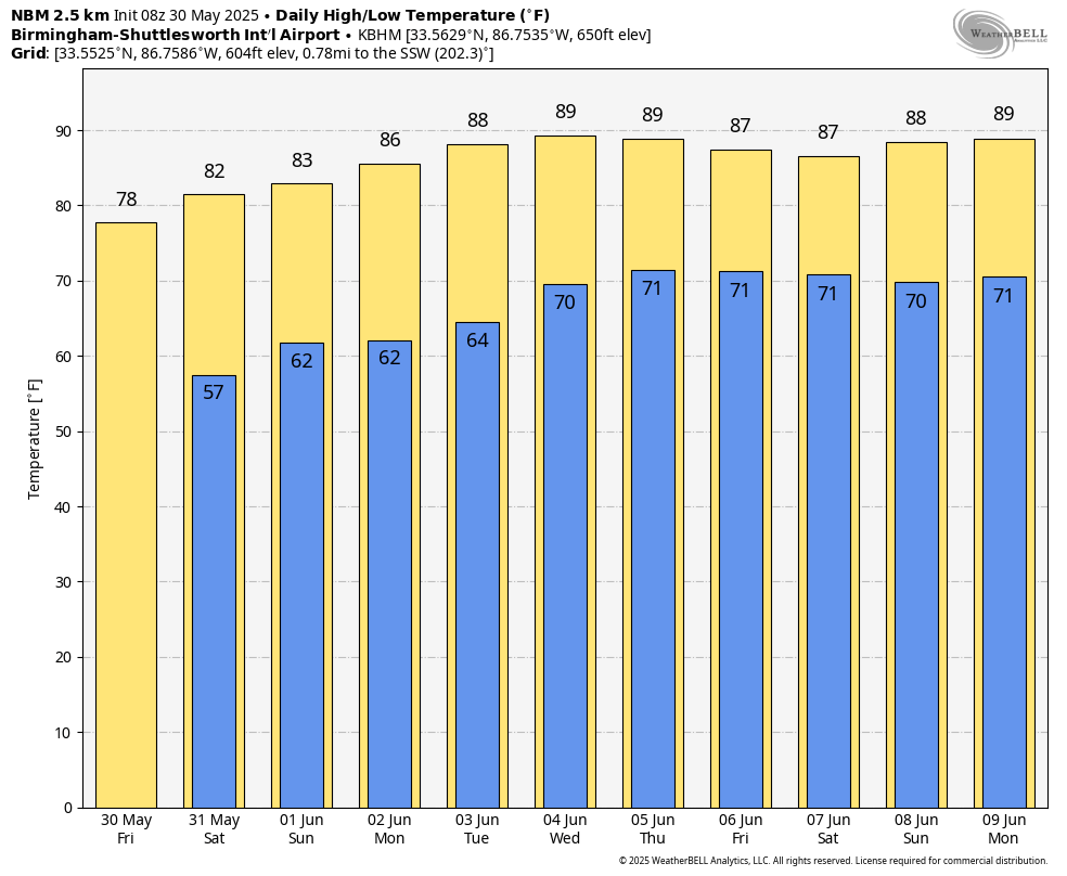
THE WEEKEND: Following the front, a much drier air mass will roll into the Deep South tonight; the sky will be clear with temperatures dropping into the 50s over northern Alabama after midnight. On Saturday, expect a sunny sky, lower humidity and a high in the low to mid 80s. Most of the day Sunday will be dry, but a few isolated afternoon showers could pop up as moisture levels begin to slowly rise. Sunday’s highs will be in the mid 80s.
NEXT WEEK: An upper ridge will build across the Gulf Coast; this will bring warmer temperatures and prevent any widespread rain. Highs will be between 85 and 91 degrees, and scattered showers or storms could show up on a few days (especially Thursday), but with the forecast pattern much of the week will be dry.
ON THIS DATE IN 1988: Memorial Day heralded heavy snow in some of the mountains and higher passes of Wyoming, closing roads in Yellowstone Park. McDonald Pass, Montana, was blanketed with 8 inches of snow.
For more weather news and information from James Spann and his team, visit AlabamaWx.