James Spann: ‘Cool’ August day for much of Alabama; scattered storms still possible

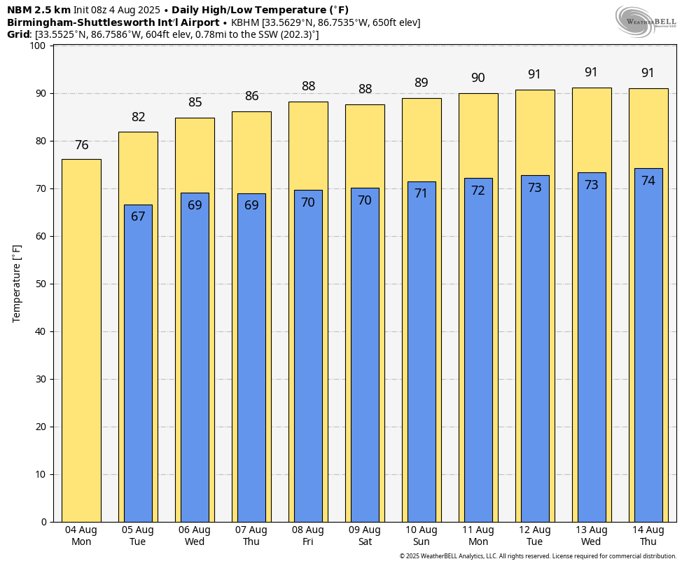
TEMPS BELOW AVERAGE: For most of Alabama temperatures will remain well below average today, the “coolest” air will be over the eastern and northern counties where highs will be in the mid to upper 70s. The record low maximum temperature for Birmingham today (August 4) is 78, set in 1966… there is a decent chance we break that record. For the western and southern counties highs will be mostly in the 85-90 degree range.
Scattered showers and storms remain possible, mainly over East and Southeast Alabama, where a flash flood watch remains in effect through tonight.
Temperatures will slowly rise each day through the rest of the week, but highs will remain below 90 for the northern counties. Scattered showers will be possible each day, but they should be isolated and not widespread.
THE ALABAMA WEEKEND: Not much change. Highs in the 87-92 degree range with the chance of a few widely scattered afternoon and evening showers and thunderstorms.
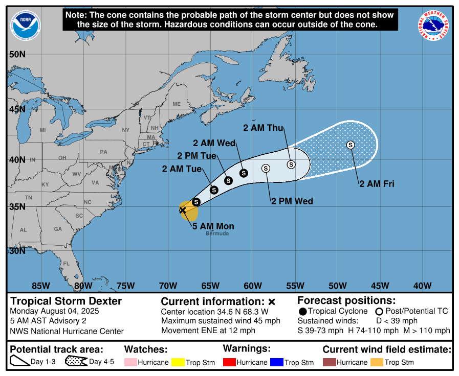
TROPICS: Tropical Storm Dexter formed in the Atlantic last night, well east of the U.S. East Coast. It will stay far from land and will become post-tropical by Wednesday night.
Elsewhere, a tropical wave is forecast to move off the west coast of Africa later today. Thereafter, some gradual development of the wave is possible, and a tropical depression could form late this week while it moves generally west-northwestward across the central tropical Atlantic. NHC gives it a 50% chance of development; if anything forms here it will turn north into the open Atlantic and is no threat land.
There is one other area of interest; a broad area of low pressure is forecast to form in a couple of days a few hundred miles off the coast of the southeastern United States. Some gradual development of this system is possible during the middle or latter part of the week as the system drifts to the west or northwest.
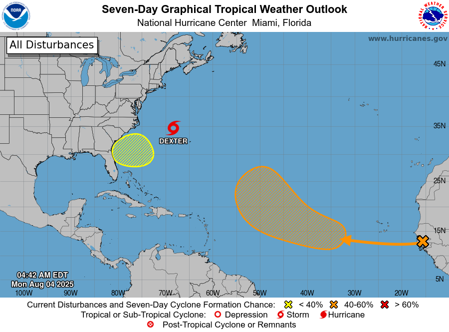
No tropical storms or hurricanes are expected in the Gulf for at least the next seven days.
ON THIS DATE IN 2008: Severe storms moved across northern Illinois and Indiana with tornadoes and stiff winds reported. With tornado sirens blaring, the game at Wrigley Field between Cubs and Astros was stopped as fans were told to evacuate to the lower concourse. Passengers at O’Hare International Airport were evacuated to lower levels of buildings as well. An estimated 350 flights were canceled.
For more weather news and information from James Spann and his team, visit AlabamaWx.com.