James Spann: Dry days ahead for Alabama, for a change

ON THE MAP: A rare July front is moving through central Alabama this afternoon. We note a few isolated showers ahead of the front around the I-85 corridor at midday; north Alabama is rain-free in drier air moving in from the north. A few isolated storms are also over the southeast corner of the state. Isolated showers will end tonight as the front continues to push southward; it should reach the northern Gulf Thursday morning.
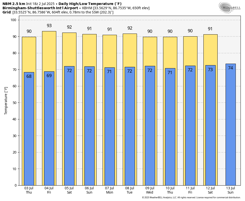
THURSDAY THROUGH THE WEEKEND: The weather looks unusually dry for summer. Afternoon showers will be almost impossible to find; expect a good supply of sunshine each day with highs mostly in the low 90s. The chance of any one spot getting wet each afternoon is 10% or less.
Even on the Gulf Coast, showers over the Fourth of July weekend will be very widely spaced; expect a partly to mostly sunny sky daily.
NEXT WEEK: Moisture levels slowly rise, so a few spotty afternoon showers or storms will be possible through the week, but there’s no sign of any elevated rain coverage based on the forecast upper air pattern.
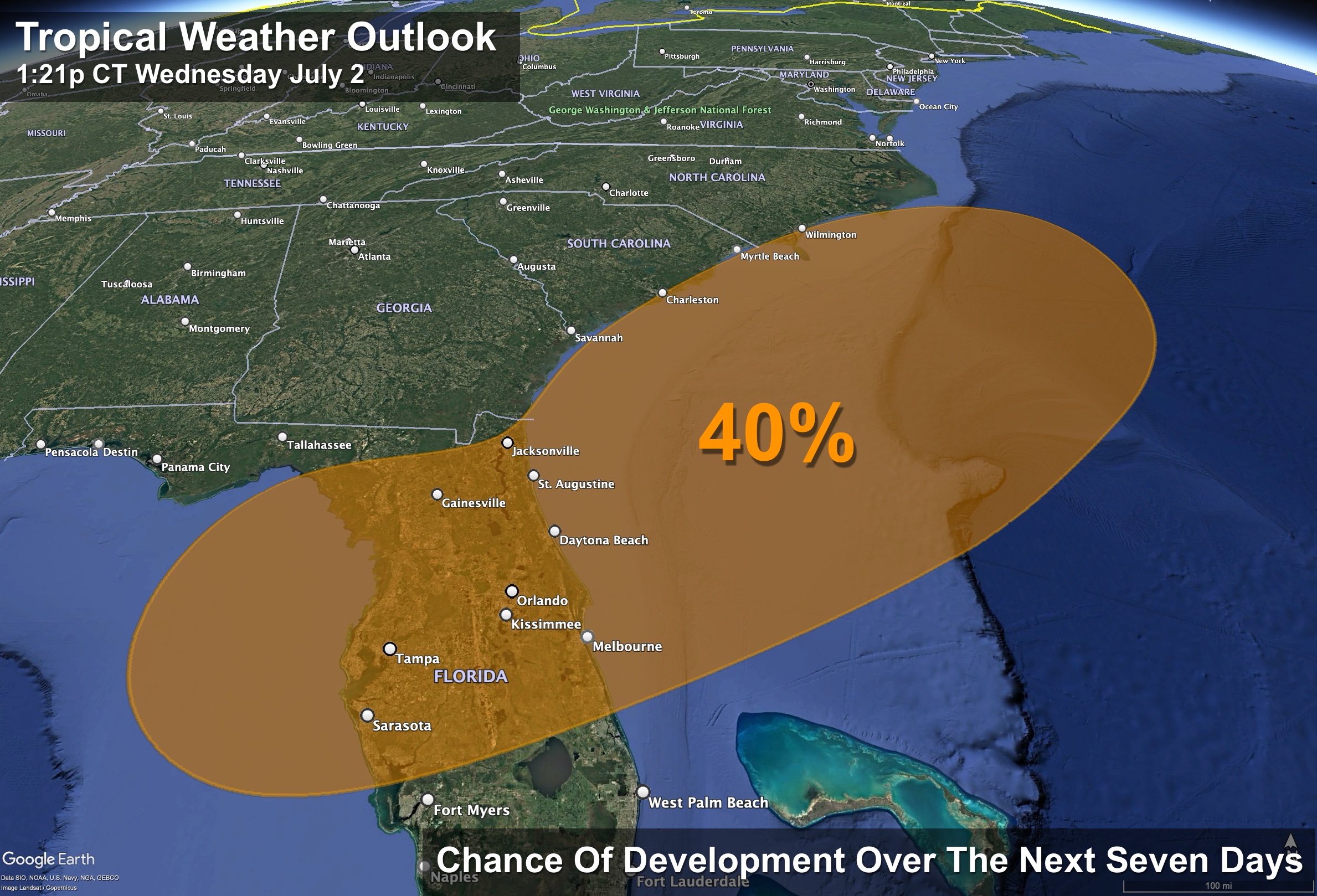
TROPICS: An area of low pressure could develop near the southeast U.S. Atlantic or Gulf coasts by this weekend along a weakening frontal boundary. Environmental conditions appear only marginally conducive for some slow development, but a tropical or subtropical depression could form in this region over the weekend or early next week while the system drifts northward or northeastward. Regardless of development, heavy rainfall is possible across portions of the southeast U.S., particularly across the west-central Florida coast (places like Tampa, St. Petersburg and Sarasota).
The National Hurricane Center is showing a 40% chance of development; global models suggest the higher chance is over the Atlantic, not the Gulf. The weather looks very favorable this weekend for the central Gulf Coast (Gulf Shores to Panama City Beach) with a good supply of sunshine daily and only widely scattered storms.
ON THIS DATE IN 1843: An alligator reportedly fell from the sky onto Anson Street in Charleston, South Carolina, during a thunderstorm.
ON THIS DATE IN 2001: In Michigan, frost and freezing temperatures were observed in some locations, with Grant dropping to 29 degrees. Muskegon reported its coldest July temperature on record, 39 degrees.
For more weather news and information from James Spann and his team, visit AlabamaWx.