James Spann: Dry, very warm in Alabama today and Friday; a few weekend storms

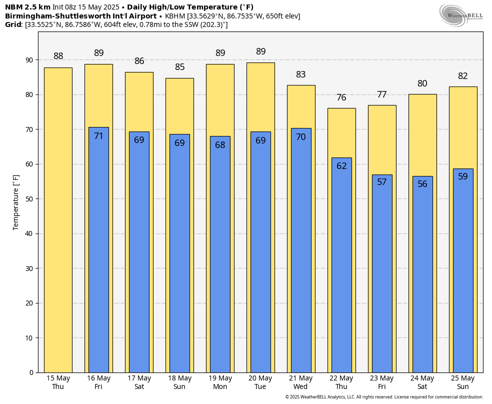
DRY: All of Alabama should be rain-free today and Friday; with a partly sunny sky, afternoon temperatures reach the 87- to 90-degree range for most communities.
THE WEEKEND: A surface front will push a line of showers and storms into Alabama from the north before dawn Saturday; that line should reach the Alabama/Tennessee border around 3-4 a.m. These storms could be strong to possibly severe across the northern third of the state with strong, gusty winds.
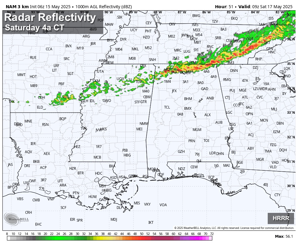
These storms will drift southward after daybreak and weaken; a decent part of the midday should be rain-free.
Then, scattered storms will form during the afternoon and evening as temperatures rise into the mid 80s. The afternoon thunderstorms will be rather random, and it won’t rain everywhere. But where they form, the storms could produce strong, gusty winds and some small hail. These scattered storms will fade quickly after sunset.
On Sunday we expect a mix of sun and clouds with a high in the 80s, and again we will likely see scattered, random showers and storms developing south of the stalled front over southern Tennessee. The weekend certainly won’t be a washout, but from time to time a passing shower or thunderstorm is possible. The best chance of scattered storms will be over the northern two-thirds of the state; far south Alabama and the Gulf Coast will be dry thanks to an upper ridge.
NEXT WEEK: Much of Monday and Tuesday will be very warm and dry, with only isolated storms for the northern counties. A more organized rain mass will move into the state Tuesday night into Wednesday. A few strong storms will certainly be possible then, but for now it looks like the higher severe weather potential will be north and west of Alabama. Cooler air rolls into the state late in the week, with highs dropping into the 70s Thursday and Friday; lows will be mostly in the 50s. Some of the cooler spots over north Alabama could reach the upper 40s by early Friday morning.
ON THIS DATE IN 1957: An F4 tornado killed 20 people in Silverton, Texas. A 5,000-pound gasoline storage tank was reportedly carried 1.5 miles and dropped into a lake.
ON THIS DATE IN 1968: An F5 tornado moved through Butler, Chickasaw, Floyd, Franklin and Howard counties in northeast Iowa, killing 13 people.
For more weather news and information from James Spann and his team, visit AlabamaWx.