James Spann: Francine grows stronger; tropical rain ahead for Alabama

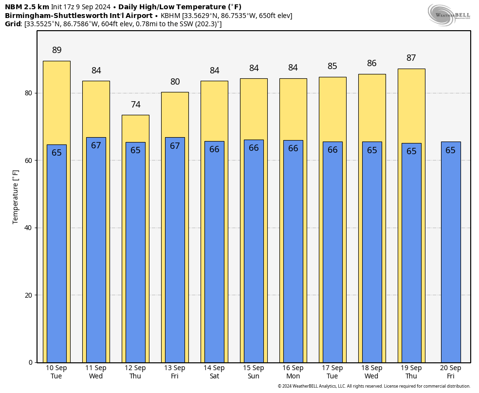
RADAR CHECK: The northern half of Alabama is enjoying a mostly sunny afternoon with temperatures between 86 and 90 degrees; clouds cover parts of south Alabama, and a few showers are near the Gulf Coast. Most of the state will be dry tonight with a low in the 60s and low 70s.
The weather won’t change much Tuesday — mostly dry for Alabama with a few showers near the coast; highs will remain between 87 and 91 for most communities.
TROPICAL RAIN: Francine is expected to make landfall on the Louisiana coast Wednesday evening, and rain will spread over all of Alabama Wednesday night and Thursday. Rain amounts for west Alabama could exceed 2 inches, while the eastern counties can expect 1-2 inches. Totals will be higher along the coast, where amounts will be 2-5 inches over southern Mobile and Baldwin counties. Gradient winds could gust to 45 mph along the Alabama Gulf Coast Wednesday and Wednesday night.
A few isolated, brief tornadoes can’t be ruled out Thursday across Alabama if sufficient instability can develop. Gradient winds on Thursday could gust to 30 mph, mainly over the western counties.
The remnant circulation of Francine will meander around northwest of Alabama, and we will need to maintain some risk of showers and thunderstorms daily Friday through Sunday — not a washout, but some rain is certainly possible from time to time with highs in the 80s.
NEXT WEEK: The risk of showers will persist for at least the first half of the week with highs holding in the 80s.
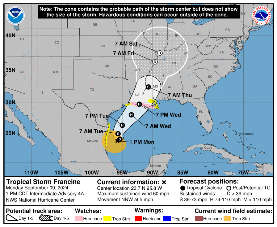
TROPICS: Tropical Storm Francine is packing sustained winds of 60 mph and is about 450 miles south/southwest of Cameron, Louisiana, this afternoon. The system is moving to the north/northwest at only 5 mph.
The National Hurricane Center (NHC) forecast has Francine making landfall on the coast of Louisiana east of Cameron late Wednesday afternoon as a Category 1 hurricane with 85 mph winds. A hurricane watch is in effect for the Louisiana coast from Cameron eastward to Grand Isle.
The main impact will be east of the circulation center; heavy rain will fall across southeast Louisiana and parts of Mississippi, Alabama and the Florida Panhandle. The heaviest rain for the Alabama Gulf Coast will come Wednesday, Wednesday night and very early Thursday. The weather will improve there during the day Thursday as Francine moves north. Tropical rain continues through Thursday afternoon over the northern two-thirds of Alabama.
The rip-current danger will be high along the central Gulf Coast Tuesday night through Friday.
A few brief, isolated tornadoes are possible east of the center Wednesday night and Thursday across parts of southeast Louisiana, Mississippi and Alabama.
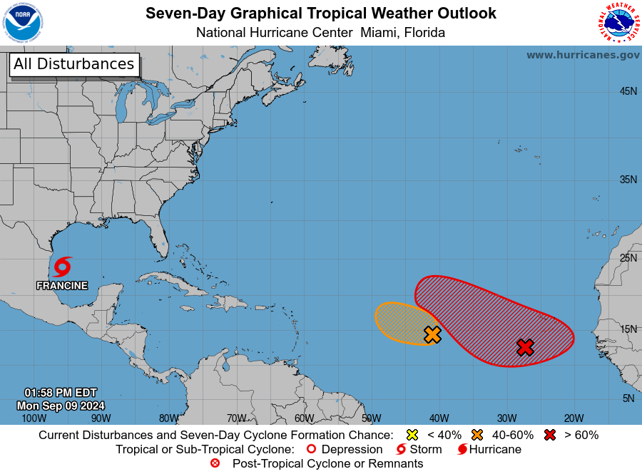
 Elsewhere, the NHC is watching two features in the central Atlantic, both with some chance of development over the next seven days. They are far from land, and global models suggest they could gain latitude and turn north before reaching the Lesser Antilles; they are just something to watch for now.
 ON THIS DATE IN 1965: Hurricane Betsy slammed into New Orleans, where 110 mph winds and power failures were reported. The eye of the storm passed southwest of New Orleans on a northwesterly track. The northern and western eyewalls covered southeast Louisiana and the New Orleans area from about 8 p.m. until 4 the next morning. In Thibodaux, winds of 130 mph to 140 mph were reported. The Baton Rouge weather bureau operated under auxiliary power, without telephone communication.
For more weather news and information from James Spann and his team, visit AlabamaWx.