James Spann: Heat levels fall in Alabama later this week with higher rain coverage

HOT: Alabama’s weather won’t change much today; most places will see a high between 93 and 98 degrees with a partly to mostly sunny sky. A few isolated showers are on radar early this morning; a few showers and storms will be around through the day, especially this afternoon.
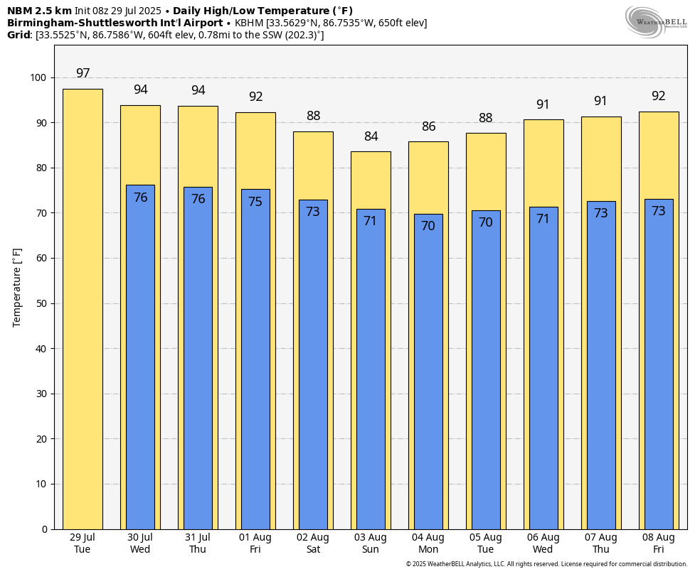
After today, heat levels will slowly fall over the latter half of the week, and coverage of scattered showers and thunderstorms will slowly rise as an upper ridge weakens over the region. The chance of any one spot seeing rain is 40-50% Wednesday and 55-65% Thursday and Friday. By Friday the high will be between 88 and 93 degrees.
THE ALABAMA WEEKEND: Heat levels continue to fall; highs will be in the 80s across much of the state with scattered to numerous showers and thunderstorms both days. Most, but not all, of the showers will come from noon through 10 p.m.
NEXT WEEK: Many north Alabama communities will continue to see highs in the upper 80s Monday and Tuesday (low 90s for south Alabama); then highs will be between 90 and 93 degrees statewide over the latter half of the week. Each day will have the usual chance of scattered, mostly afternoon and evening showers and thunderstorms.
TROPICS: All remains quiet across the Atlantic basin; no tropical storms or hurricanes are expected for at least the next seven days.
ON THIS DATE IN 1960: Severe thunderstorms brought damaging winds, possibly as high as 100 mph, to central Oklahoma. Eight planes and several hangars were damaged at Wiley Post Airfield, while two aircraft and additional hangars were damaged at Will Rogers World Airport. The winds caused seven injuries in the area, including two youths who were injured by flying debris.
ON THIS DATE IN 2020: Tropical Storm Isaias formed, marking the earliest “I” storm on record in the Atlantic. On July 31, Isaias became a hurricane.
For more weather news and information from James Spann and his team, visit AlabamaWx.