James Spann: Hot, humid summer days for Alabama, with a few spotty showers and storms

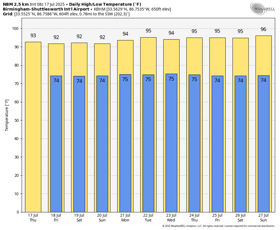
JULY IN ALABAMA: This is the time of the year when the weather just doesn’t change much. You can say “hot and humid with an afternoon thunderstorm in spots” and be right almost every day. And that is our situation through next week. The average high for Birmingham on July 17 is 91, and we expect highs generally in the low 90s through the weekend, right where we should be for this time of the year. A few spots across northwest Alabama could reach the mid 90s.
The chance of any one spot seeing an afternoon shower today over the northern half of the state is 20-30%; odds are a little higher over the southern counties, where moisture will be deeper on the east side of a broad tropical low near the Mississippi coast. In fact, there are a few scattered showers in progress early this morning over the far southern part of Alabama rotating around the low.
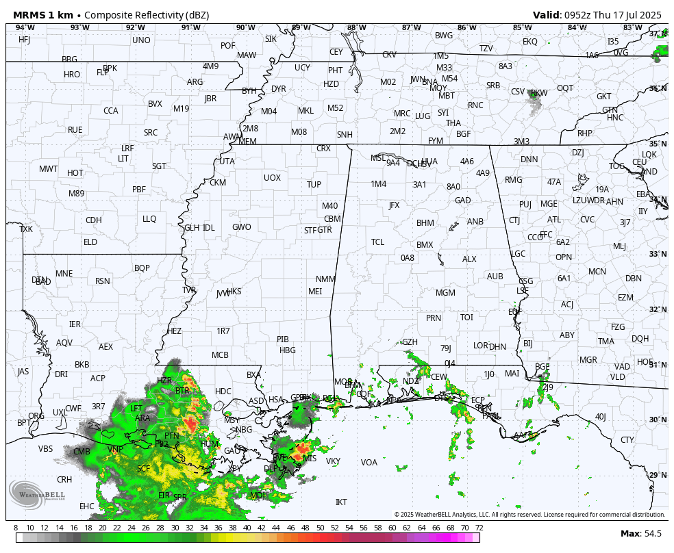
Coverage of afternoon and evening showers and storms will be a little higher Friday and over the weekend, but it won’t rain everywhere. Most (but not all) of the showers will come from around 1 until 10 p.m. The sky will be partly sunny.
With a stronger upper ridge, afternoon highs will likely be in the mid 90s on most days next week with just a few isolated afternoon and evening showers and storms.
TROPICS: Recent satellite wind data, in combination with surface and radar observations, indicate the broad area of low pressure over
the far northern portion of the Gulf remains quite disorganized. In addition, the associated shower and thunderstorm activity remains displaced well west of the broad center. While some additional development of this system remains possible over the next 12-24 hours, its current structure suggests its chances of developing into a tropical depression before it reaches the Louisiana coast later today are fading fast.
The chance of development has dropped to 30%. The only significant impact for the central Gulf Coast is a high danger of rip currents today and Friday. The rest of the Atlantic basin remains very quiet.

ON THIS DATE IN 1942: A great flood developed over the Smethport area in Pennsylvania, resulting in an estimated 34.5 inches of rain in just one day, including 30.6 inches in only six hours, setting a world record. The official observing site, Smethport Highway Shed, reported only 13.08 inches for the entire month because the flood consumed the gauge after 6.68 inches of rain. The total resulted from the substitution of the officially estimated amount for the amount measured.
ON THIS DATE IN 1987: Slow-moving thunderstorms caused flooding on the Guadalupe River in Texas, resulting in tragic loss of life. A bus and van leaving a youth summer camp stalled near the rapidly rising river, just west of the town of Comfort, about 50 miles northwest of San Antonio. The powerful surge of water swept away 43 people, mostly teenagers. Ten drowned. Most of the others were rescued from treetops by helicopter. This event was very similar to the flood tragedy in the same spot two weeks ago.
For more weather news and information from James Spann and his team, visit AlabamaWx.