James Spann: Hot summer days for Alabama, with a few strong storms this afternoon

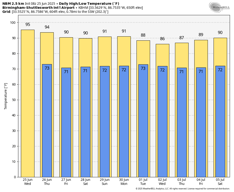
SUN AND STORMS: Hot, humid summer weather continues across Alabama today and Thursday, with afternoon highs in the mid 90s in most places. During the peak of the heat, random, widely scattered showers and storms will develop. The Storm Prediction Center has much of Alabama in a severe weather risk both days; surface-based instability will be very high, and heavier storms that form will be capable of producing strong winds and small hail. The chance of any one spot seeing a thunderstorm is 20-25% today and 35-40% Thursday. Most of the storms will develop between 1 and 9 p.m.
FRIDAY AND THE WEEKEND: The upper high over the eastern half of the U.S. will weaken, which will mean slightly lower heat levels and a high coverage of afternoon showers and thunderstorms. Highs will be between 88 and 92 degrees, and odds of any one specific location seeing an afternoon storm will rise into the 50-60% range.
NEXT WEEK: Humid summer weather continues with a continued trend toward lower heat levels. Highs will be between 85 and 90 degrees on most days with the typical chance of a passing shower or thunderstorm daily during the afternoons and evenings.
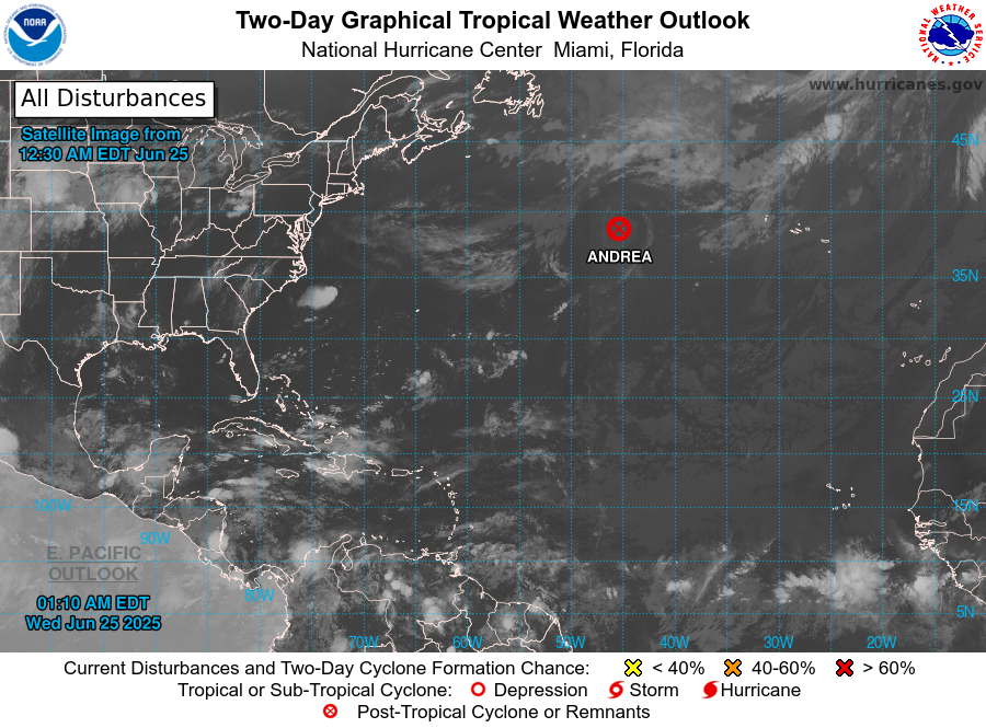
TROPICS: The weak system that the National Hurricane Center designated Tropical Storm Andrea over the middle of the Atlantic Tuesday has already dissipated this morning. The Atlantic basin remains very quiet, and tropical storm formation is not expected for at least the next seven days.
ON THIS DATE IN 1957: Audrey reached hurricane strength; it was moving northward through the Gulf of Mexico; it would make landfall two days later near Sabine Pass and would be one of the deadliest hurricanes in U.S. history.
ON THIS DATE IN 1967: Three F3 tornadoes crossed the Netherlands, killing seven people and producing widespread damage.
For more weather news and information from James Spann and his team, visit AlabamaWx.