James Spann: Humid days for Alabama, with a mix of sun and storms

RADAR CHECK: A disturbance moving westward on the south side of the upper high to the north of Alabama brought widespread rain and storms to the state overnight. Rain is still falling over much of north Alabama at daybreak; some southeast counties are still seeing some rain as well. The early morning rain will fade soon, and much of the state will be dry from midmorning through early afternoon.
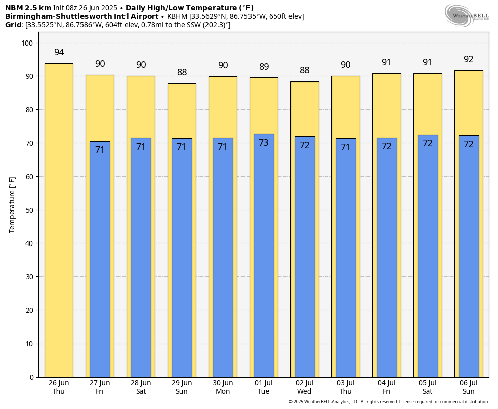
Temperatures will rise into the 90- to 94-degree range this afternoon, and as the air becomes unstable, more scattered showers and storms will form late in the day and tonight. A few storms could produce strong, gusty winds; the Storm Prediction Center has all of Alabama in a marginal risk (level 1 out of 5) of severe storms.
FRIDAY AND THE WEEKEND: The summer mix of sun and storms will continue. The best chance of a passing shower or storm will come during the afternoons and evenings, and the chance of any one spot getting wet each day is 55-65%. Afternoon highs will be between 88 and 92 degrees, which is just what we expect in late June in Alabama.
NEXT WEEK: The summer pattern will stay in place through the week and into the Fourth of July weekend. Each day we will have a mix of sun and clouds with scattered showers and thunderstorms, mainly in the 1-10 p.m. time frame. Highs will remain in the upper 80s and low 90s for most communities.
TROPICS: The Atlantic basin remains very calm. Tropical storm and hurricane formation is not expected for at least the next seven days.
ON THIS DATE IN 1986: Hurricane Bonnie made landfall on the upper Texas coast. A wind gust to 98 mph occurred at Sea Rim State Park. Ace, Texas, recorded 13 inches of rain.
For more weather news and information from James Spann and his team, visit AlabamaWx.