James Spann: Mix of sun, afternoon storms for Alabama; heat levels drop this weekend

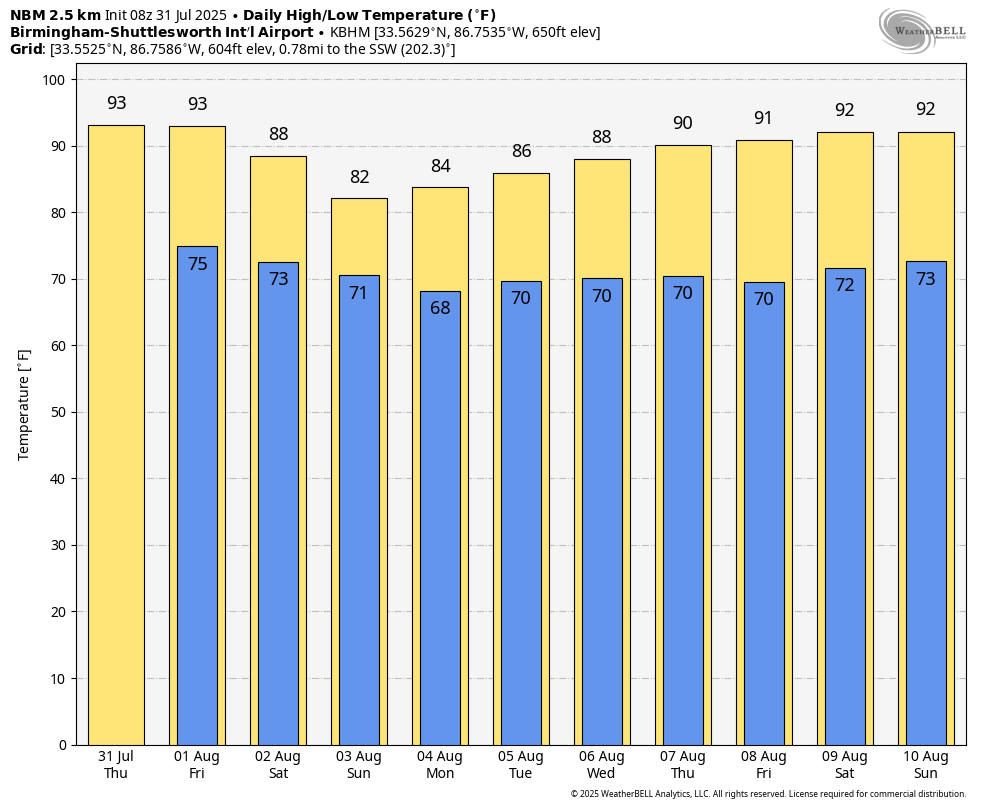
SUN AND STORMS: Alabama’s weather won’t change much today and Friday. Highs will be 91 to 95 degrees for most places, with afternoon and evening showers and thunderstorms in scattered spots. Most of the storms will come from noon to midnight, and where they form, the stronger ones will produce heavy rain, gusty winds and gobs of lightning. The chance of any one spot seeing a shower or thunderstorm is 50-60%.
THE ALABAMA WEEKEND: Heat levels fall considerably. Highs drop into the 85- to 90-degree range Saturday, and many north Alabama communities will see a high only in the low 80s Sunday, a good 10 degrees below average for early August. Some places could set a new record-low maximum temperature. Expect a mix of sun and clouds both days with scattered showers and thunderstorms, most active between 1 and 10 p.m.
NEXT WEEK: Temperatures will likely stay below average for the first half of the week, but low 90s will return by Thursday and Friday. Like we expect in August, we will continue to deal with random, scattered, mostly afternoon and evening showers and thunderstorms through the week.
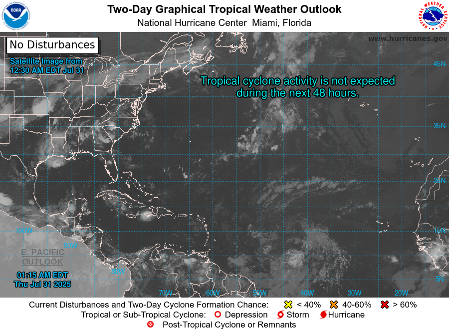
TROPICS: Again today, the Atlantic basin remains amazingly calm, and we expect no tropical storm or hurricane formation at least for the next seven days.
ON THIS DATE IN 1936: A hurricane with winds of 105 mph slammed into Walton County in the Florida Panhandle. It weakened rapidly over land and dissipated over west Alabama on Aug. 1.
ON THIS DATE IN 1987: The second-deadliest tornado in Canadian history occurred in Edmonton, Alberta. An F4 tornado killed 27 people, injured more than 300 and caused a quarter of a billion dollars in damage.
For more weather news and information from James Spann and his team, visit AlabamaWx.