James Spann: Mostly dry in Alabama Saturday; scattered storms Sunday

RADAR CHECK: Showers are almost impossible to find across Alabama this afternoon… the sky is partly to mostly sunny with temperatures in the 85-90 degree range for most communities. A few isolated showers or storms remain possible through early tonight, but most places will be dry.
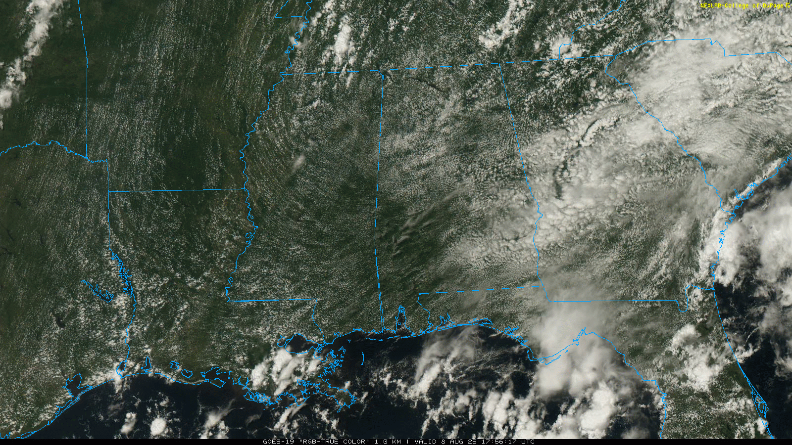
The chance of any one spot seeing a shower or storm across Alabama tomorrow will remain in the 10-20% range … otherwise expect a partly to mostly sunny sky with highs in the 86-92 degree range. Moisture will be a little deeper, and air a little more unstable Sunday, so the number of scattered showers and storms will likely increase, mostly between noon and midnight. The high Sunday will be in the mid to upper 80s for a decent part of the state.
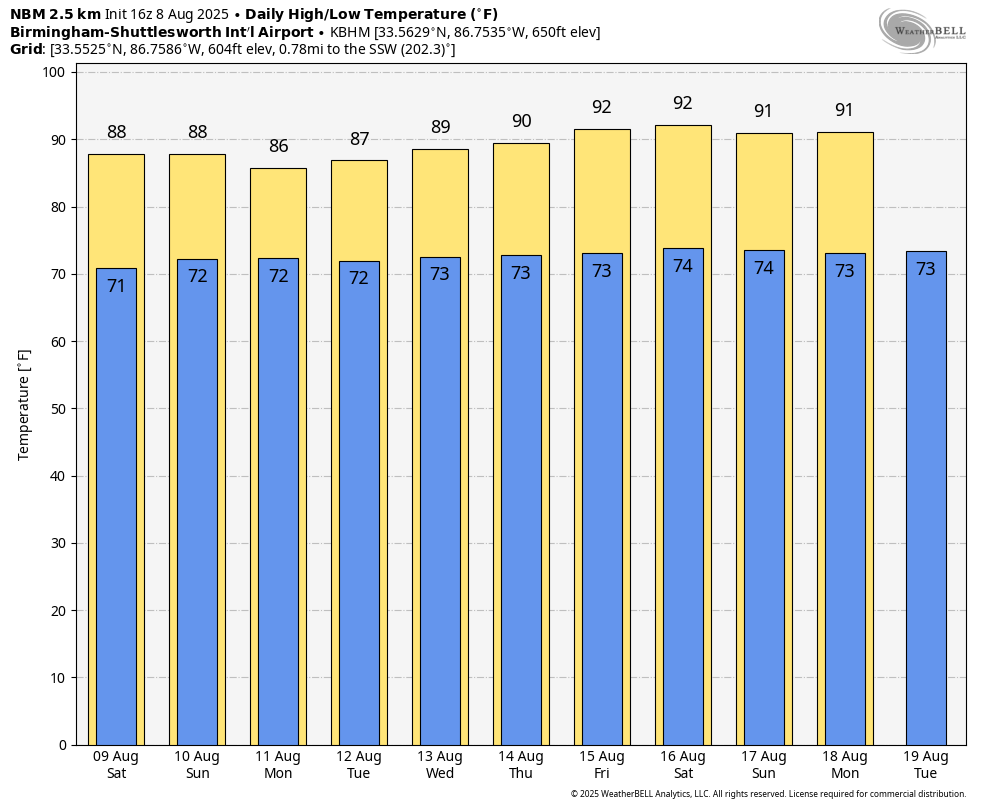
NEXT WEEK: Warm, humid weather continues through the week with the daily round of scattered showers and storms, most active during the afternoon and evening hours. The chance of any one community seeing rain each day is in the 50-60% range, and highs will be in the 86-92 degree range for much of the week. See the video briefing for maps, graphics, and more details.
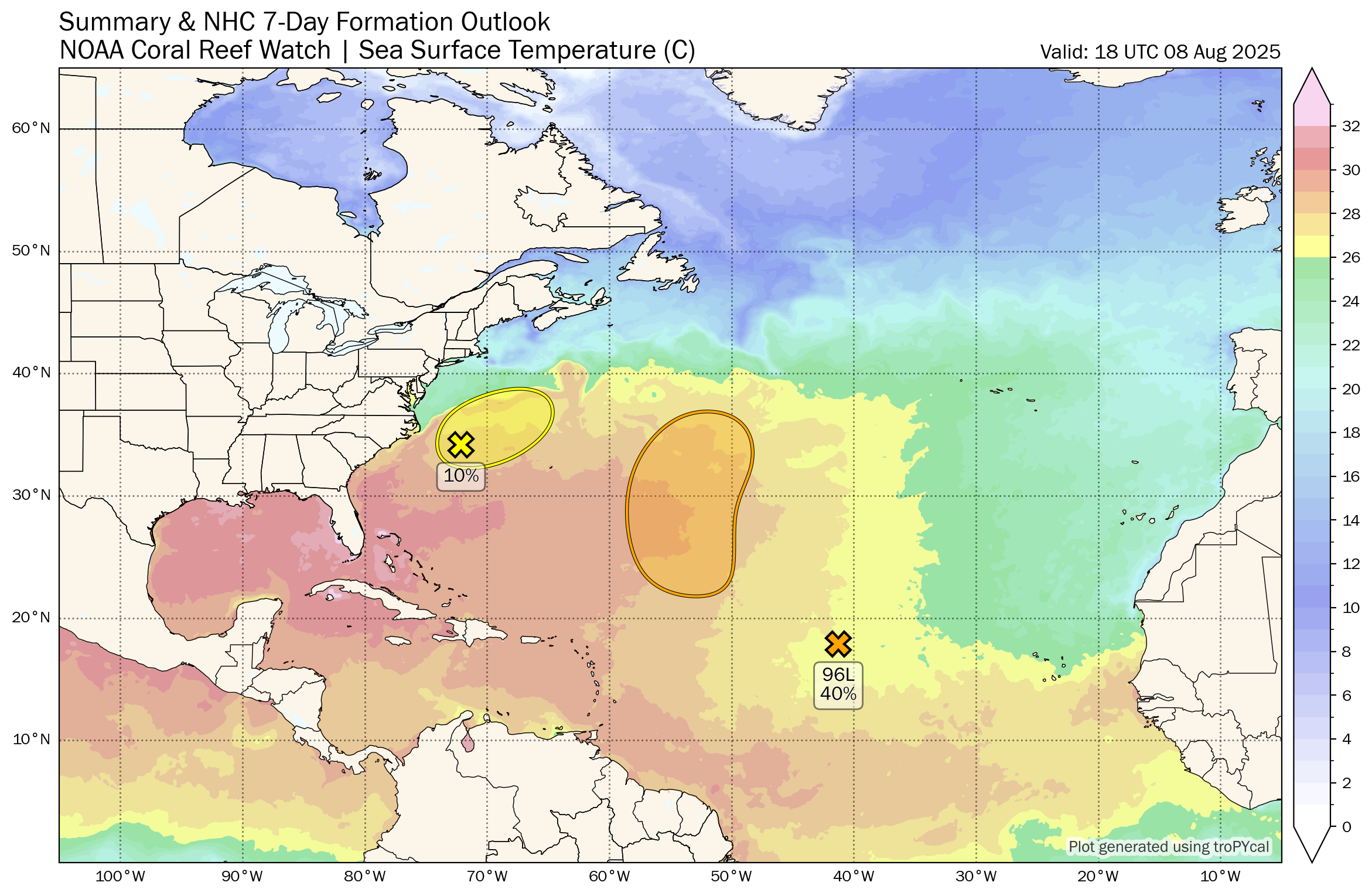
TROPICS: A weak area of low pressure located a couple of hundred miles off the coast of North Carolina is producing a few disorganized showers and thunderstorms. Development of this system, if any, is expected to be slow to occur over the next day or so while it moves northeastward at 10 to 15 mph. The low is likely to merge with a front over the weekend, ending its chances for tropical or subtropical development. The chance of development has dropped to 10%.
Also, a tropical wave (Invest 96L) over the central tropical Atlantic is producing minimal shower activity. Development of this system appears unlikely during the next day or two due to surrounding dry air, but environmental conditions are forecast to become more conducive in a few days. A tropical depression could form during the early or middle part of next week while the system moves northwestward to northward across the central tropical and subtropical Atlantic. The chance of development has dropped to 40%.
No tropical storms or hurricanes are expected across the Gulf for at least the next seven days.
ON THIS DATE IN 2007: A tornado bounces across Staten Island and Brooklyn, New York, ripping off roofs and damaging dozens of buildings. The EF-2 twister hop-scotched through Brooklyn’s Bay Ridge and Sunset Park neighborhoods around 6:30 a.m.
For more weather news and information from James Spann and his weather team, visit AlabamaWx.com.