James Spann: Occasional showers, strong storms for Alabama today

RADAR CHECK: Just before daybreak large areas of rain and thunderstorms are over west and south Alabama. Some are producing small hail and very heavy rain as they move slowly to the east/northeast. The northern counties are dry.
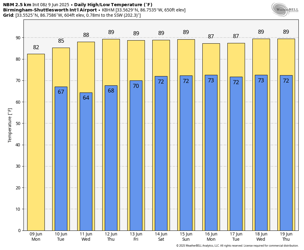
The Storm Prediction Center has all of Alabama in a slight risk (level 2 out of 5) of severe thunderstorms today; heavier storms will be capable of producing strong, gusty winds and hail. But it won’t rain all day, and some spots could miss the rain completely. The chance of any one spot getting wet is 70-75%. Temperatures reach the low 80s this afternoon, which is below average for June in Alabama.
REST OF THE WEEK: The weather gradually shifts back to a more typical summer pattern, with showers and storms becoming fewer and more widely spaced. The chance of any one spot getting wet Tuesday and Wednesday will be 30-40%, with the highest coverage over the southern half of the state. Scattered, mostly afternoon and evening showers and storms will be around Thursday and Friday with afternoon temperatures rising into the upper 80s.
THE WEEKEND: Classic summer weather continues with warm, humid days, a partly sunny sky and the chance of a shower or storm in scattered spots. Afternoon highs will be in the upper 80s in most spots, which is what we expect in mid-June. The chance of any given location seeing rain both days is 40-45%, and most of the showers will come from around 2 until 10 p.m.
Most likely this summer pattern continues into next week.
TROPICS: All remains quiet across the Atlantic basin, and tropical storm formation is not expected through at least the next seven days.
ON THIS DATE IN 1966: Hurricane Alma made landfall over the eastern Florida panhandle, becoming the earliest hurricane to make landfall on the United States mainland.
For more weather news and information from James Spann and his team, visit AlabamaWx.