James Spann: Rain returns to Alabama later this week

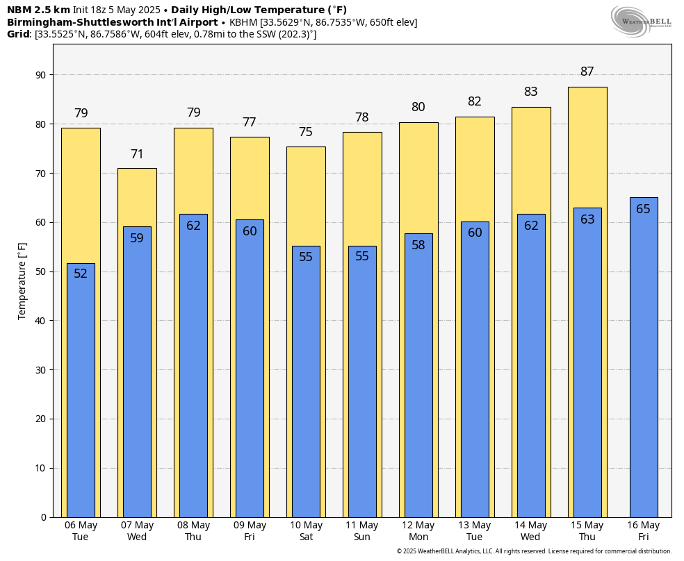
PLEASANT SPRING DAY: The sky is partly to mostly sunny across Alabama this afternoon with temperatures in the 60s and 70s. A few isolated showers could form this evening over the Tennessee Valley; otherwise, tonight will be mostly fair with a low in the 50s. Cooler spots go back in the 40s.
Tuesday will be dry for most of the state, but a few showers could creep into the southwest counties by late afternoon. The high will be between 77 and 82 degrees.
RAIN RETURNS: The latter half of the week will be wet at times. We expect occasional rain Wednesday through Friday as an upper low slowly approaches from the west. Some thunder is possible, but severe storms are not expected. Rain amounts will be 1-2 inches for most of Alabama on these three days, but heavier amounts are possible mainly over the southern part of the state. Highs will remain in the 70s.
THE ALABAMA WEEKEND: The upper low will weaken and continue drifting eastward. Alabama’s weather trends drier, with a partly sunny sky forecast Saturday and Sunday. Any showers should be widely spaced, and mainly over the southern quarter of the state. Highs will be between 75 and 80 degrees both days.
For now, much of next week looks dry with highs returning to the 80s Tuesday through Friday.
ON THIS DATE IN 1933: An estimated F4 tornado moved from near Brent and Centreville to Helena before dawn. It killed 14 and injured 150 while demolishing more than 100 buildings. Much of Helena was destroyed. Another tornado the same day killed four people at Demopolis.
ON THIS DATE IN 1995: A supercell thunderstorm brought torrential rains and large hail up to 4 inches in diameter to Fort Worth, Texas. This storm also struck a local outdoor festival known as the Fort Worth Mayfest. At the time the storm was the costliest hailstorm in the history of the United States, causing more than $2 billion in damage.
For more weather news and information from James Spann and his team, visit AlabamaWx.