James Spann: Scattered showers, storms for Alabama Thursday; rain at times over the weekend

RADAR CHECK: A large mass of rain is moving along the Gulf Coast this afternoon; the rest of Alabama is dry with a mix of sun and clouds and temperatures mostly in the 70s. Rain is likely for the far southern part of the state this evening; elsewhere only a few isolated showers will be around tonight with a low in the 60s.
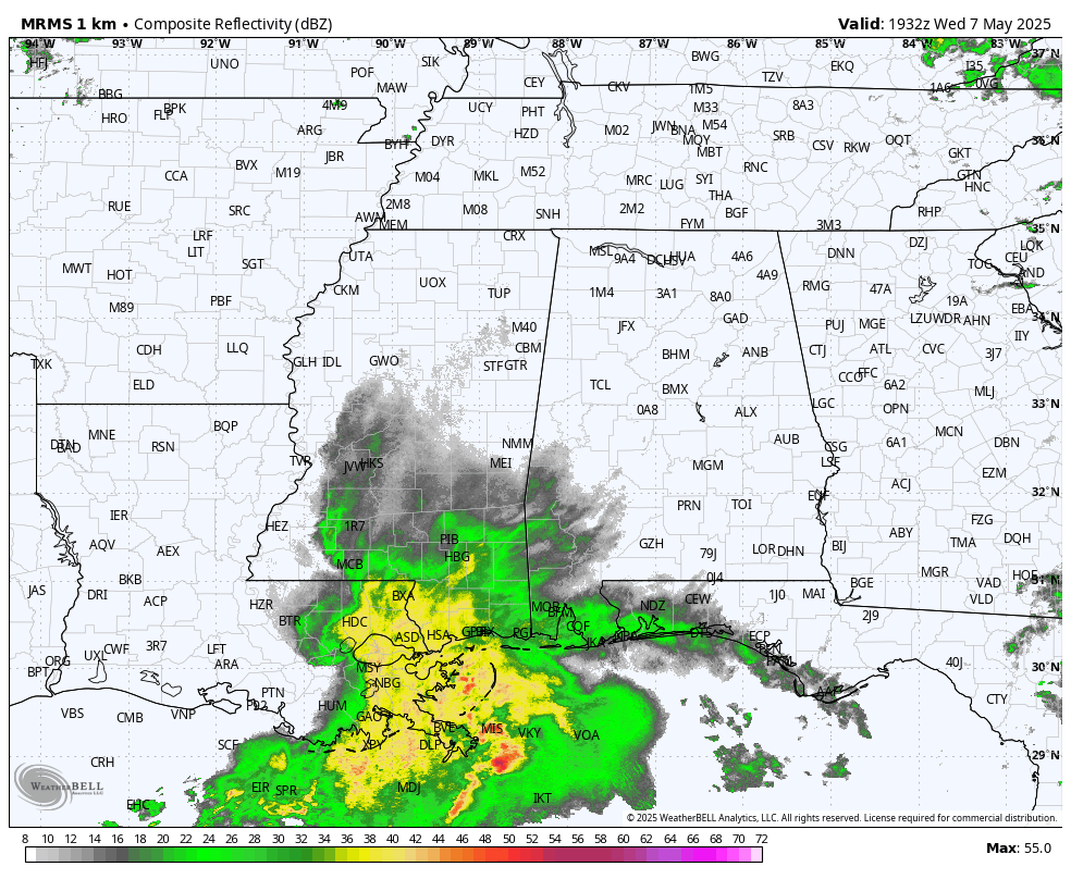
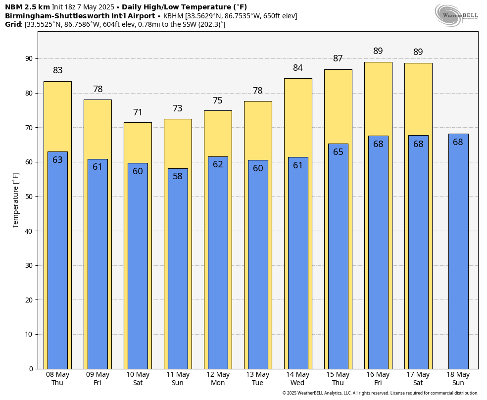
We are forecasting a mix of sun and clouds Thursday with a high in the low 80s; a few scattered showers and storms are likely, especially during the afternoon and evening.
FRIDAY AND THE WEEKEND: As the upper trough to the west slowly approaches, we expect periods of rain on all three days. It won’t be a total washout, and the sun could peek out. But if you have an outdoor event planned, be ready for some rain at times. Some thunder is possible, but we are not expecting severe thunderstorms. Highs will be in the mid to upper 70s for most places. Rain amounts between now and Sunday could exceed 4 inches over south Alabama; amounts of 1-3 inches are likely for the northern half of the state.
NEXT WEEK: We will maintain a chance of rain at times on Monday and Tuesday, but the latter half of the week will be generally dry and much warmer. In fact, highs will be close to 90 degrees by the end of the week as an upper ridge begins to build.
ON THIS DATE IN 1993: Serious flooding occurred in central Oklahoma following torrential rain and hail on May 7-8. Rainfall amounts on this date were generally around 1 inch. Oklahoma City then recorded 6.64 inches of rain on May 8, the third-greatest daily rainfall amount ever observed in the city. Extensive flooding resulted, which killed four people, and the fire department had to rescue 183 others.
For more weather news and information from James Spann and his team, visit AlabamaWx.