James Spann: Scattered storms for Alabama Friday through Sunday, some strong

RADAR CHECK: Most of Alabama is dry this afternoon with a mix of sun and clouds. We note a few spotty, isolated showers over mainly the southern half of the state. Showers will end soon after sunset; tonight will be mostly fair with a low between 68 and 74 degrees.
FRIDAY THROUGH SUNDAY: A surface front will slowly approach from the north, and scattered afternoon and evening storms should be more numerous each day, especially over the northern half of the state. The weekend won’t be a washout at all, but where storms do form, they will be heavy, with potential for strong winds. The Storm Prediction Center has placed much of north and central Alabama in severe weather risks Friday and Saturday. Some small hail will also be possible with the stronger storms, but no tornado concerns. Most, but not necessarily all, of the storms will come from about 2 until 10 p.m.
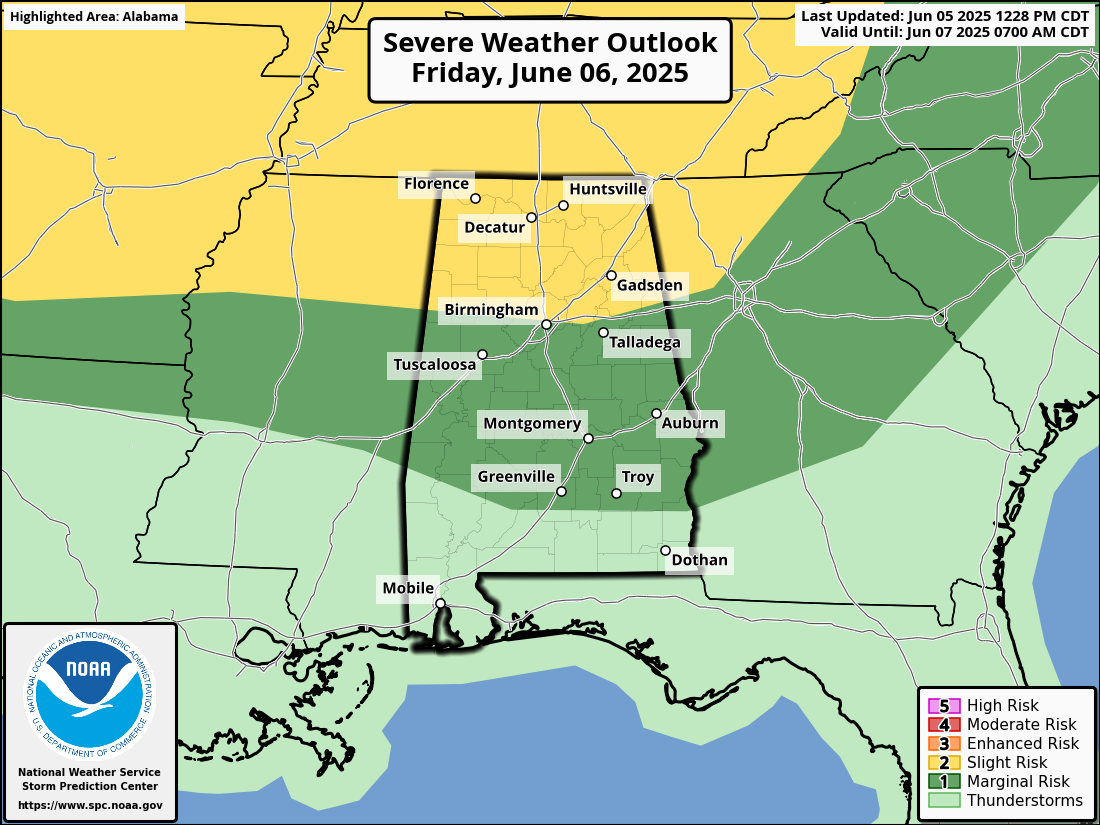
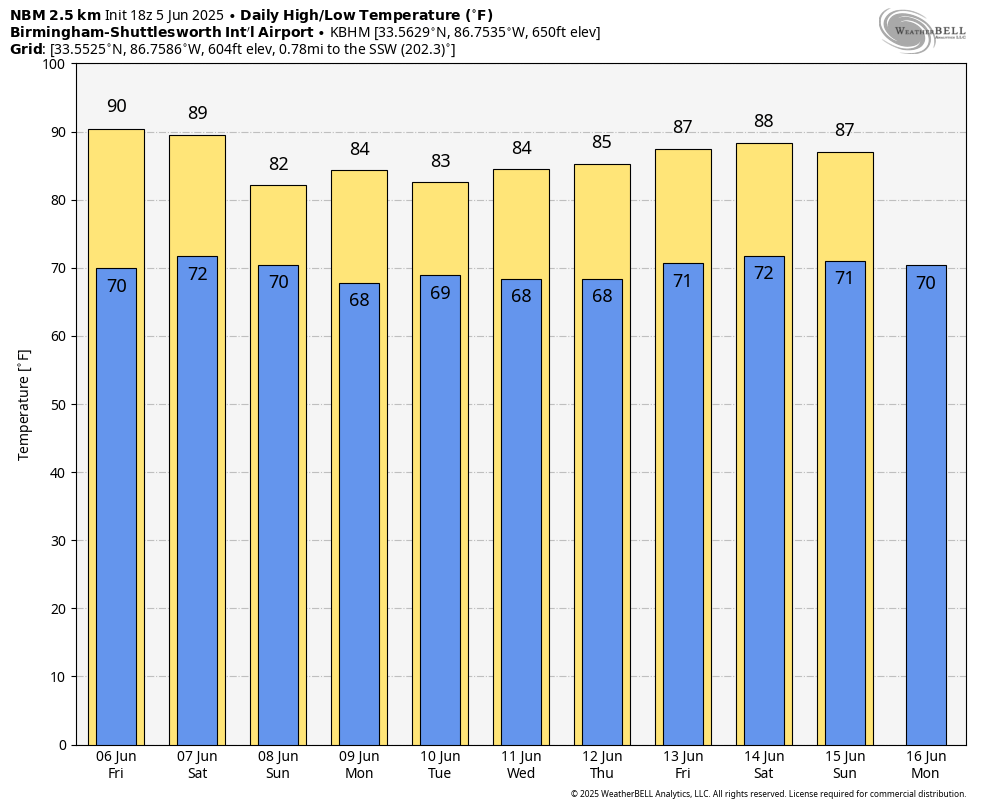
Away from the storms, the sky will be partly sunny over the weekend with highs in the 80s.
NEXT WEEK: A typical summer pattern will be in place with a humid air mass hanging across the Deep South. Expect partly sunny days with scattered showers and thunderstorms daily during the afternoons and evenings. Highs will remain in the 80s through the week.
TROPICS: All remains very quiet across the vast Atlantic basin, and tropical storm formation is not expected for at least the next seven days.
ON THIS DATE IN 1976: When water began leaking from Idaho’s new Teton Dam, there seemed to be no cause for alarm. On this date, warnings were frantic that the dam was about to break. As workers tried to shore up the dam, it crumbled shortly after 11 a.m., sending 180 billion gallons of water pouring through Teton Canyon. Eleven people lost their lives, but the toll would have been much higher if the dam had failed at night and residents had been asleep.
For more weather news and information from James Spann and his team, visit AlabamaWx.