James Spann: Scattered to numerous showers, storms for Alabama with drop in heat levels ahead

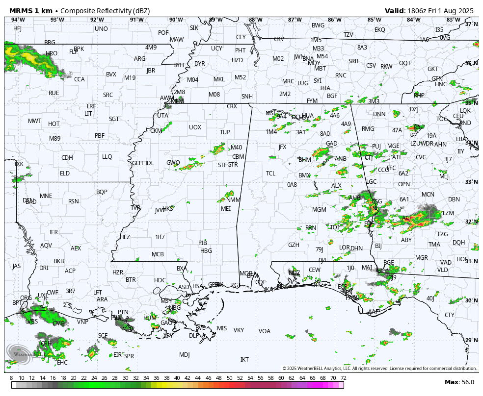
RADAR CHECK: Like all other days this week, we have a number of showers and thunderstorms in progress in scattered spots. Stronger storms are producing heavy rain, gusty wind and frequent lightning. Temperatures are mostly in the upper 80s and low 90s; showers will end late tonight.
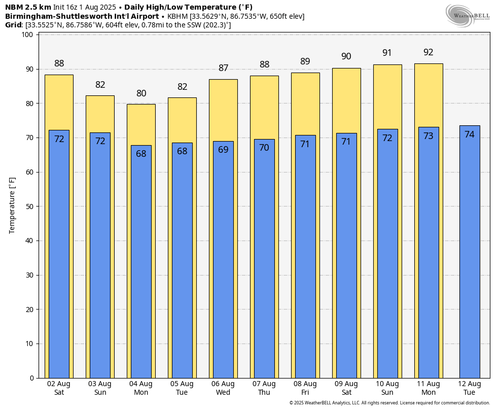
 HEAT LEVELS COMING DOWN: A decent part of Alabama will stay under 90 degrees Saturday as heat levels begin to fall. By Sunday and Monday, highs drop into the 78- to 84-degree range, well below average for early August. As heat levels drop, coverage of scattered showers and storms will gradually rise. The chance of any one spot seeing rain today through Monday is 55-65%. Like recent days, stronger storms will bring heavy rain, gusty winds and lots of lightning. Most, but not necessarily all, of the showers and storms will come from noon to midnight.
Temperatures will likely remain below average through next week, with highs under 90 degrees for at least the northern half of the state. Each day we will have the usual dose of scattered, mostly afternoon and evening showers and thunderstorms.
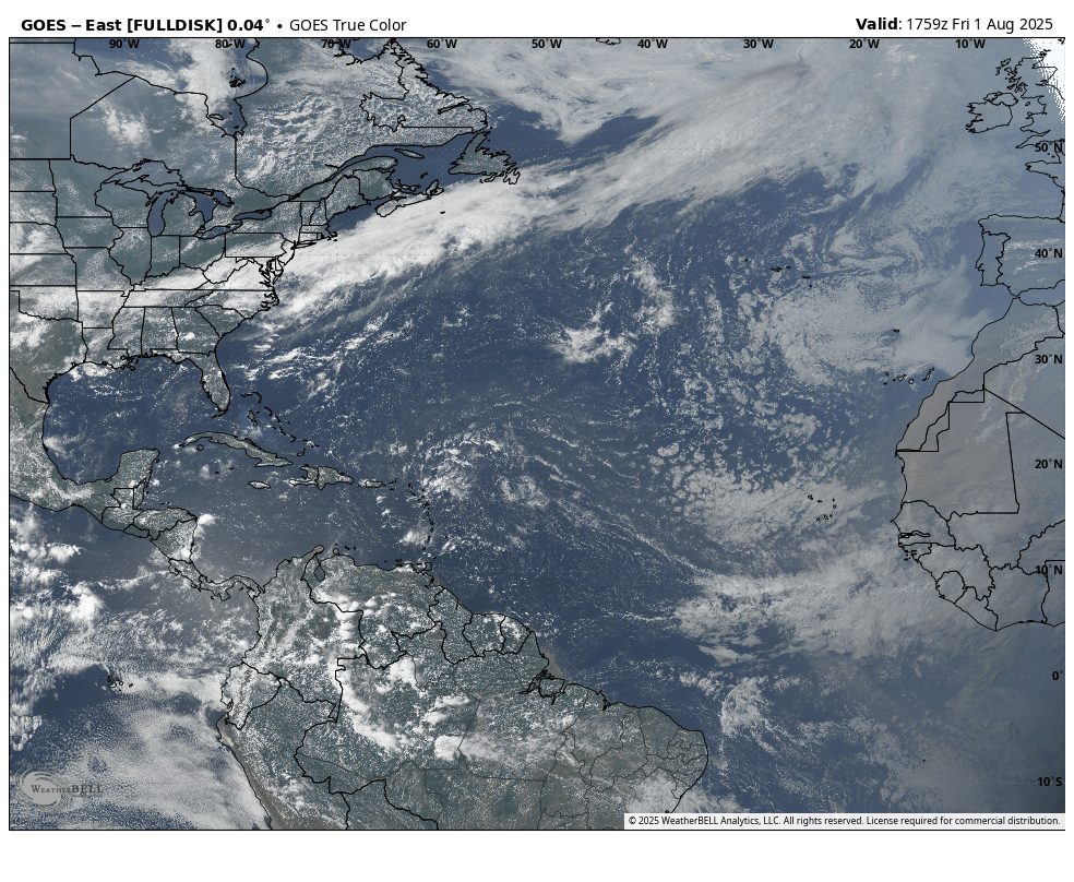
TROPICS: The Atlantic basin remains very calm. There’s no sign of tropical storms or hurricanes at least for the next seven days.
 ON THIS DATE IN 1983: During the early afternoon, a strong microburst swept across Andrews Air Force Base in Washington, D.C. Although the base anemometer was not calibrated at extreme wind speeds, the peak gust hit 149 mph. It was reported that Air Force One, with President Reagan on board, landed less than 10 minutes before the peak gust.
For more weather news and information from James Spann and his team, visit AlabamaWx.