James Spann: Showers, storms return to Alabama tonight, Thursday

DRY AFTERNOON: Most of Alabama is rain-free for a change this afternoon; with a partly sunny sky, temperatures are mostly in the 80s. High-resolution models suggest thunderstorms could push through parts of the state tonight, mainly the southern counties. Overnight lows will be in the 60s.
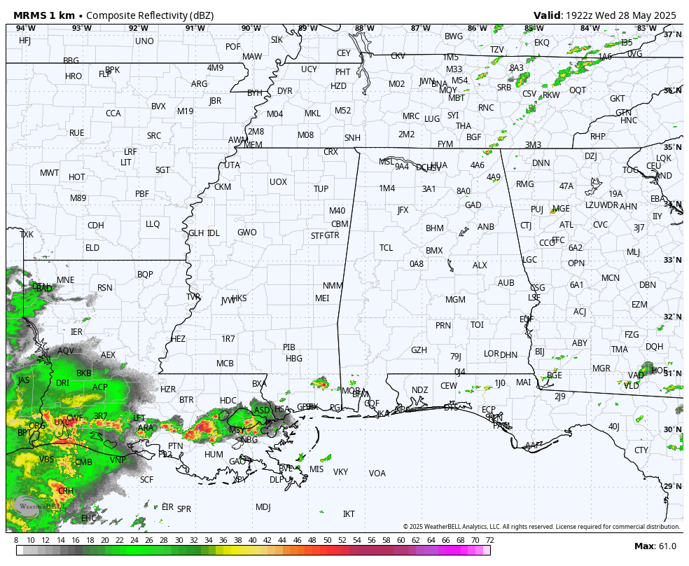
A few passing showers and thunderstorms are likely Thursday and Friday as the unsettled pattern continues, but a cold front will be pushing through the state Friday afternoon and night and will bring an air-mass change just in time for the weekend. For now, we are expecting rain-free weather Saturday and Sunday with mostly sunny days, clear, cool nights and lower humidity levels.
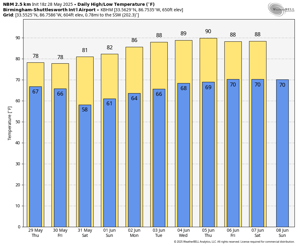
Temperatures will drop into the 50s over north Alabama early Saturday morning, followed by a high in the mid to upper 70s with sunshine in full supply. South Alabama will reach the low 80s. Sunday will be partly to mostly sunny with a high in the 80s.
NEXT WEEK: An upper ridge will begin to build across the Deep South, meaning rising temperatures as we begin meteorological summer. Highs will be between 87 and 91 degrees over the latter half of the week. We could see a few isolated showers or storms on a few days, but for now there is nothing to suggest any especially widespread or heavy rain.
RAIN UPDATE: Here are updated rain totals for May at the major reporting stations across Alabama:
- Tuscaloosa — 13.83 inches
- Huntsville — 10.88
- Birmingham — 10.35
- Anniston — 9.43
- Montgomery — 8.61
- Mobile — 7.29
- Muscle Shoals — 4.89
- Dothan — 4.47
ON THIS DATE IN 1962: An early-season heat wave was underway across the Deep South. Birmingham’s high was 99 degrees, which still stands as the record high for the date.
ON THIS DATE IN 1973: An F3 tornado moved east and struck the northern portion of Athens, Georgia. Destruction was massive near Athens, with losses estimated at $10 million. Damage from the storm included 545 homes and 17 businesses. Hundreds of large trees more than 100 years old were destroyed.
For more weather news and information from James Spann and his team, visit AlabamaWx.