James Spann: Showers, storms return to Alabama Tuesday night; windy at times

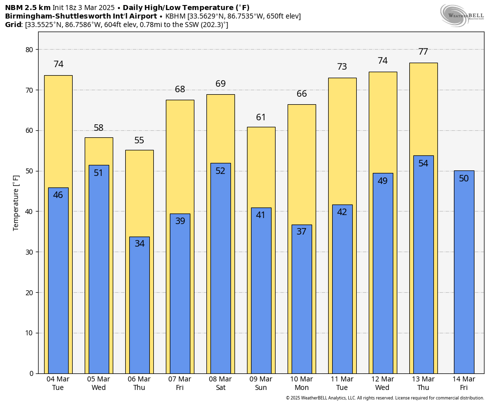
SUNNY MARCH DAY: With sunshine in full supply, temperatures are in the 60s across Alabama this afternoon. Tonight will be fair and cool, with a low in the 40s.
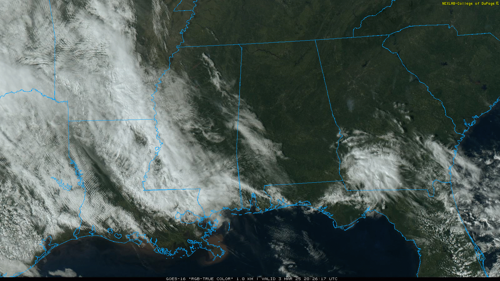
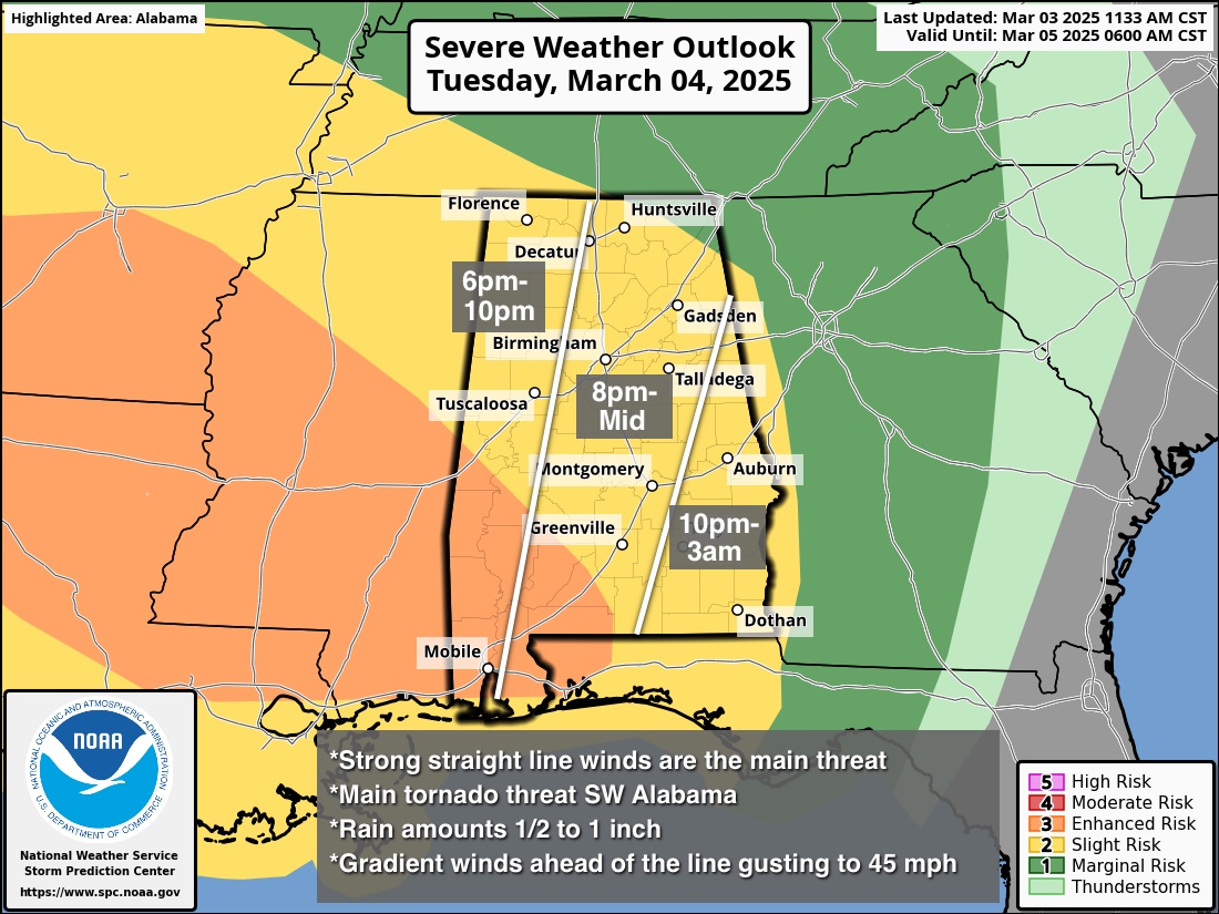
Winds will ramp up across Alabama Tuesday ahead of a line of strong to severe thunderstorms that will sweep through Tuesday night; the Storm Prediction Center (SPC) has much of the state in a slight risk (level 2 out of 5) of severe thunderstorms. It has also added an enhanced risk (level 3) for the southwest counties.
Key messages:
- There will be very little surface-based instability ahead of the line, which will limit the overall magnitude of the event. A brief, isolated tornado is possible within the line but isn’t likely for most of Alabama. However, some unstable air could very well make it into southwest Alabama, where the SPC has added the enhanced risk. A tornado or two is possible there.
- Wind fields will be impressive with a tight pressure gradient. Ahead of the line, gradient winds (non-thunderstorm) could gust to 45 mph. With the line itself, convective winds could be high enough in spots to bring down some trees and power lines.
- This will be a fast-moving line of storms; rain amounts will be one-half to 1 inch for most places. Flooding is not expected.
- The storms should enter the northwest corner of Alabama around 6-7 p.m. Tuesday and exit the southeast corner by 3-4 a.m. Wednesday.
Look for a partly sunny sky Wednesday with a high between 57 and 64 degrees; any showers will be confined to areas near the Tennessee border. Temperatures will drop near freezing over north Alabama early Thursday morning, followed by a high between 53 and 60 degrees with sunshine in full supply.
A warming trend begins Friday; with a mostly sunny sky, the high will be in the 60s.
THE ALABAMA WEEKEND: A disturbance will bring rain back into Alabama Saturday and Saturday night; it’s too early to know whether severe storms will be an issue with this system. Dry air returns Sunday; highs over the weekend will be in the 60s.
 ON THIS DATE IN 2019: A violent, long-tracked EF-4 tornado struck portions of eastern Alabama and western Georgia, causing extreme damage along its path. This was the deadliest tornado in the United States since the 2013 Moore, Oklahoma, tornado.
A total of 23 people were killed in Lee County; the victims ranged in age from 6 to 93. Of those killed, 19 were in mobile homes. Beauregard and Smiths Station were the hardest hit. Five other tornadoes touched down, including an EF-2 near Eufaula.
For more weather news and information from James Spann and his team, visit AlabamaWx.