James Spann: Storms for Alabama this evening; drier air settles in Wednesday

RADAR CHECK: We have scattered to numerous showers and thunderstorms over the southern two-thirds of Alabama this afternoon; stronger storms are producing gusty winds, heavy rain and lots of lightning. Showers and storms will end tonight as a surface front pushes southward.
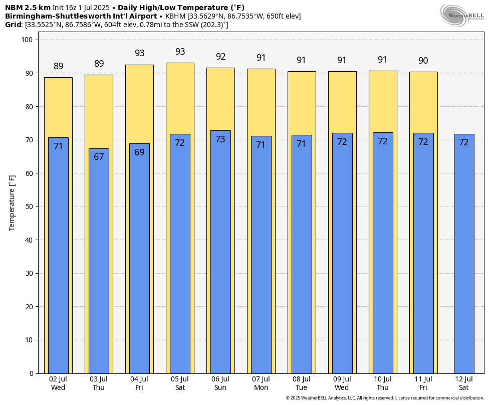
Drier air begins to push into the Deep South late tonight, and on Wednesday showers will be confined to the southern third of the state. Even there, they should be widely scattered. With a partly sunny sky, the high will be close to 90 degrees.
THURSDAY THROUGH THE WEEKEND: Global models continue to suggest an unusually dry air mass for summer will settle in here, meaning mostly sunny days, fair nights, slowly rising heat levels and lower humidity levels for the Fourth of July holiday weekend. Highs rise into the low 90s, and showers will be very hard to find statewide. A few showers could pop up Sunday afternoon as moisture levels begin to rise again, but they should be widely spaced.
NEXT WEEK: Moisture levels will continue to rise slowly, and the week will feature very routine summer weather — partly sunny days with scattered, mostly afternoon and evening showers and thunderstorms. Highs will be close to 90 degrees.
TROPICS: A frontal boundary is expected to stall and weaken off the southeastern U.S. coast late this week. An area of low pressure could develop from the weakening front by the weekend over the Atlantic waters off the southeastern U.S., over Florida or over the eastern Gulf. Some gradual tropical or subtropical development could occur thereafter as the low drifts and moves little. Regardless of development, heavy rainfall is possible across portions of the Southeast, particularly across the west-central Florida coast.
Most of the organized rain with the feature will be east of the central Gulf Coast (Gulf Shores to Panama City Beach), so don’t change any plans if you have a beach trip this weekend. The National Hurricane Center gives it a 30% chance of development.
The rest of the Atlantic basin remains very, very quiet.

ON THIS DATE IN 2002: San Antonio, Texas, recorded 9.52 inches of rain to set a new record for its greatest rainfall for July.
ON THIS DATE IN 2024: Hurricane Beryl reached Category 5 strength over the Caribbean with sustained winds of 160 mph, after making landfall on the island of Carriacou, Grenada, as a high-end Category 4 hurricane, causing total devastation.
For more weather news and information from James Spann and his team, visit AlabamaWx.