James Spann: Sun, heat, a few storms in Alabama this afternoon

RADAR CHECK: While north Alabama is hot and dry today, we have scattered showers and thunderstorms over the southern half of the state, moving westward around a broad tropical low over the western Florida Panhandle. Where the sun is out, temperatures are in the low to mid 80s; a few spots have dropped into the upper 70s thanks to showers over south Alabama. Many of the showers will fade after sunset.
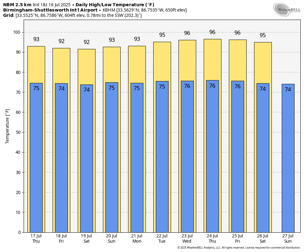
Not much change in the weather is expected Thursday. It will be partly sunny, hot and humid with a few scattered, mainly afternoon storms. Highs will be mostly in the low 90s.
THE ALABAMA WEEKEND: Pretty routine summer weather is the story for Saturday and Sunday — hot, humid days with the risk of a passing afternoon shower or storm both days. The highest coverage of showers will likely be over the western half of the state; highs will be between 91 and 94 degrees. We aren’t expecting much change through next week. Highs will be in the mid 90s on most days with a few spotty, random showers and storms during the afternoon and evening.
TROPICS: Surface and radar observations indicate that a westward-moving broad area of low pressure is along the coast of the Florida Panhandle near Panama City. The associated shower and thunderstorm activity remains disorganized and mainly south and southwest of the center. This system is forecast to continue moving westward across the northern portion of the Gulf through tonight, reaching the coast of Louisiana Thursday. The National Hurricane Center is still hanging on to a 40% chance of this becoming a tropical depression, but much of the circulation is over land and development isn’t especially likely.
For the central Gulf Coast (Gulf Shores to Panama City Beach), the main issue is a high danger of rip currents Thursday and Friday. Otherwise, the weather looks pretty routine with the classic mix of sun and a few scattered storms.
The rest of the Atlantic basin remains very quiet.

ON THIS DATE IN 1979: The most damaging tornado in Wyoming history touched down 3 miles west-northwest of the Cheyenne airport. This strong tornado moved east or east-southeast across the northern part of Cheyenne, causing $22 million in damage and one fatality. In all, 140 houses and 17 trailers were destroyed, and 325 other homes were damaged. Four C-130 aircraft and National Guard equipment sustained $12 million damage. Municipal hangars and buildings sustained $10 million in losses.
ON THIS DATE IN 1980: Birmingham’s high was 105 degrees, the seventh consecutive day of triple-digit heat as the generational heat of 1980 continued.
For more weather news and information from James Spann and his team, visit AlabamaWx.