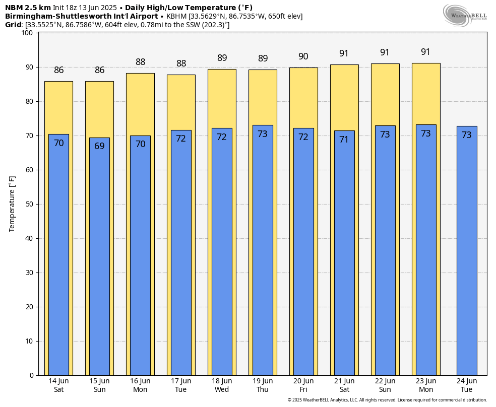
James Spann: Sun plus storms for Alabama over the weekend, with highs in the mid to upper 80s

RADAR CHECK: Scattered showers and thunderstorms are in progress across Alabama this afternoon, with the highest coverage over the western half of the state. Stronger storms are producing heavy rain, gusty winds and lots of lighting. Showers will fade after sunset.
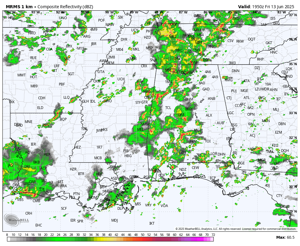
SUMMER DAYS: We will have a classic summer mix of sun and scattered showers and thunderstorms over the weekend. A weak upper trough to the west will bring an uptick in the number of showers, but the overall forecast is pretty routine for June. Look for a mix of sun and clouds each day with scattered showers and storms most active from 2 until 10 p.m.
The chance of any one spot getting wet each day is 60-65%, and heavier storms will produce strong wind gusts and lots of lightning, much like today. Temperatures will be very close to average, with highs mostly in the mid to upper 80s.
NEXT WEEK: The overall pattern stays the same — partly sunny days with the risk of a passing shower or thunderstorms during the afternoons and evenings. Afternoon showers should be fewer over the latter half of the week as an upper ridge builds across the Deep South. Heat levels will also creep up, with highs close to 90 on most days.
TROPICS: The Atlantic basin remains very calm, and tropical storm formation is not expected for at least the next seven days.
ON THIS DATE IN 1976: A deadly tornado moved across parts of the southwestern Chicago suburbs, killing three people and injuring 23 others. The tornado, with winds in excess of 200 mph, moved from Lemont to Downers Grove, causing $13 million in damage when 87 homes were destroyed and another 90 were damaged. The tornado passed over the Argonne National Laboratory, peeling part of a roof off the building housing a nuclear reactor.
For more weather news and information from James Spann and his team, visit AlabamaWx.