James Spann: Sun, scattered storms for Alabama through the weekend

RADAR CHECK: We have a classic summer look to the radar this afternoon. Random, scattered showers and thunderstorms are moving northward. Stronger storms are producing gusty winds, heavy rain and lots of lightning. But much of the state is dry and partly to mostly sunny, with temperatures in the mid to upper 80s. Scattered showers will fade after sunset.
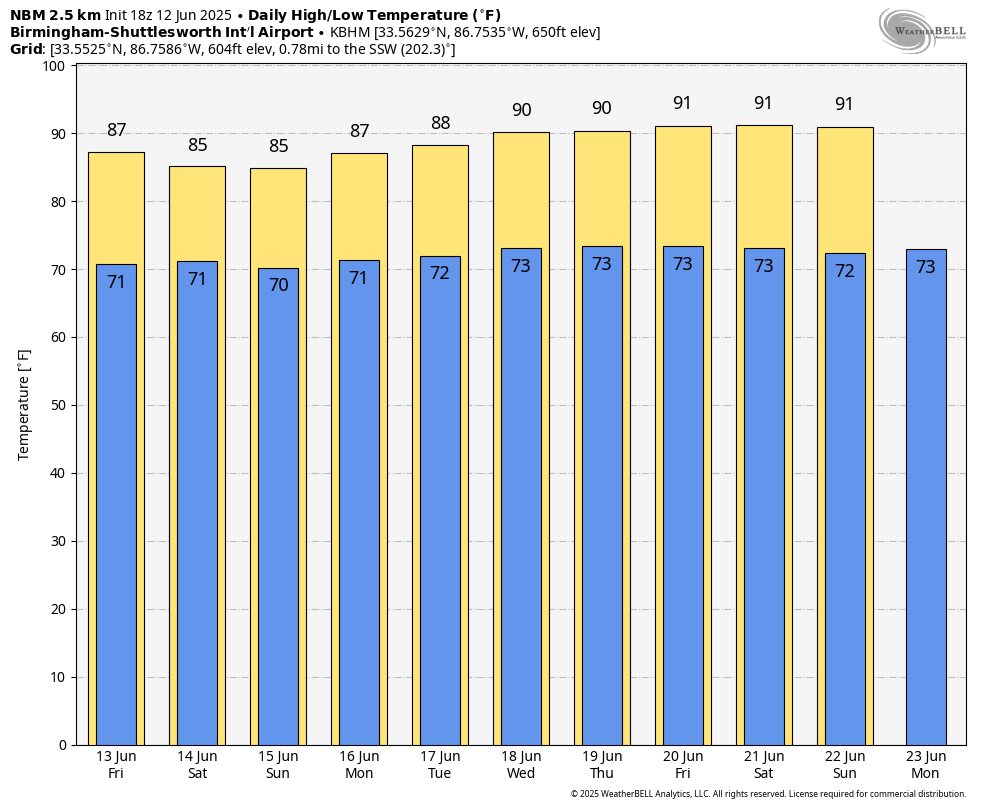
FRIDAY AND THE WEEKEND: The overall idea remains the same — sun at times plus scattered showers and thunderstorms daily with highs in the mid to upper 80s, right at seasonal averages for mid-June. Coverage of showers and storms will be enhanced to some degree by a weak trough to the west; the odds of any one spot getting wet each day are around 60%. Most, but not all, of the showers and storms will come from about 2 until 10 p.m. Unlike last weekend, organized severe thunderstorms are not expected, but the heavier storms will produce gusty winds and very frequent lightning.
NEXT WEEK: Expect partly sunny, warm, very humid days with a few random showers or storms during the afternoons and evenings. Showers should be fewer as an upper ridge builds across the Deep South. This ridge will also bring hotter afternoons; most Alabama communities will see a high in the low 90s over the latter half of the week.
TROPICS: The Atlantic basin is calm, with no tropical storms and no hurricanes for at least the next seven days.
ON THIS DATE IN 1915: An estimated F4 tornado moved northeast from northwest of Waterville, Iowa, crossing the Mississippi River two miles south of Ferryville, Wisconsin. A man and his daughter were killed in one of three homes that were obliterated southwest of Heytman, a small railroad station on the Mississippi River.
For more weather news and information from James Spann and his team, visit AlabamaWx.