James Spann: Sun, storms for Alabama this weekend

RADAR CHECK: A few scattered showers and thunderstorms are over Alabama this afternoon; they are most numerous over the Tennessee Valley. Away from storms the sky is partly to mostly sunny with temperatures mostly in the upper 80s and low 90s. Scattered showers will end after sunset.
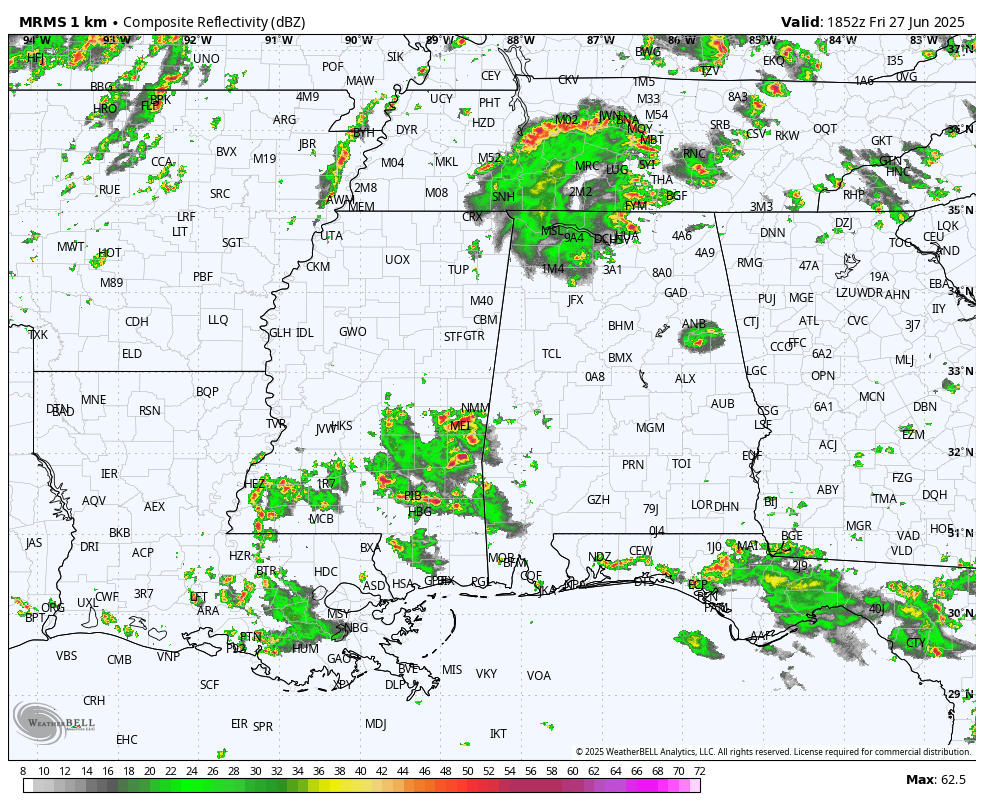
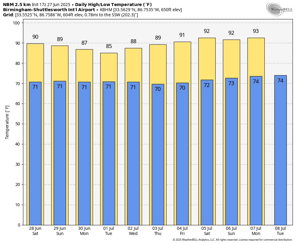
MUGGY SUMMER DAYS: We have some pretty classic summer weather for Alabama and the Deep South over the weekend, with partly sunny days, highs between 88 and 92 degrees and the usual risk of scattered, mostly afternoon and evening showers and thunderstorms. Most (but not necessarily all) of the showers and storms will come from around 1 until 10 p.m., and the chance of any one spot seeing rain is 55-65%. Where storms do form, they will be strong, with potential for gusty winds and lots of lightning.
NEXT WEEK: The overall pattern won’t change much with a broad upper ridge in place and weak winds aloft. A surface front could approach the northern part of the state, which could enhance the coverage of afternoon showers and storms around midweek, followed by a trend toward fewer showers Thursday and Friday. Temperatures remain very close to average for late June and early July, with highs in the upper 80s and low 90s for most communities.
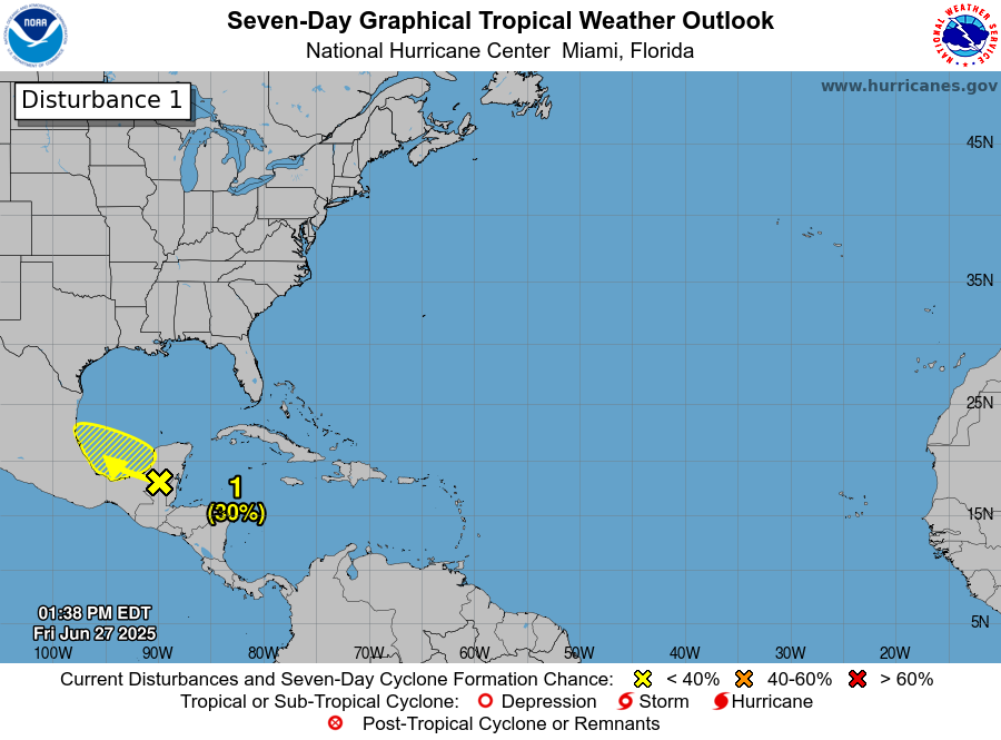
TROPICS: A broad area of low pressure has formed over the Yucatan Peninsula in association with a large area of disorganized showers and thunderstorms over the northwestern Caribbean Sea and the Yucatan Peninsula. Some additional development is possible over the next few days when the system moves into the Bay of Campeche this weekend. By early next week this system should move inland over Mexico, ending its chances of additional development. Regardless of development, heavy rains are possible over portions of Belize, Guatemala and southeastern Mexico during the next few days.
The National Hurricane Center gives this feature a 30% chance of development over the next seven days. The rest of the Atlantic basin, including most of the Gulf, remains very quiet.
ON THIS DATE IN 1957: Hurricane Audrey made landfall at Sabine Pass and Johnsons Bayou, Louisiana. Audrey ranks as the seventh-deadliest hurricane to strike the United States (the third-deadliest within Louisiana) in modern record keeping, with at least 416 deaths. The exact number will never be known, as many perished in the storm surge in Cameron and Vermilion parishes, and many missing persons were never found.
Along with Hurricane Alex in 2010, it was also the strongest June hurricane ever recorded in the Atlantic basin as measured by pressure. The rapidly developing storm struck southwestern Louisiana as an intense Category 3 hurricane, destroying coastal communities with a powerful storm surge that penetrated as far as 20 miles inland. Prior to making landfall, Audrey severely disrupted offshore drilling operations in the Gulf of Mexico. Damages from offshore oil facilities alone was estimated at $16 million. Audrey caused much of its destruction near the border between Texas and Louisiana. The hurricane’s strong winds resulted in widespread property and infrastructural damage.
For more weather news and information from James Spann and his team, visit AlabamaWx.