James Spann: Warm, hazy Tuesday for Alabama; scattered storms return Wednesday afternoon

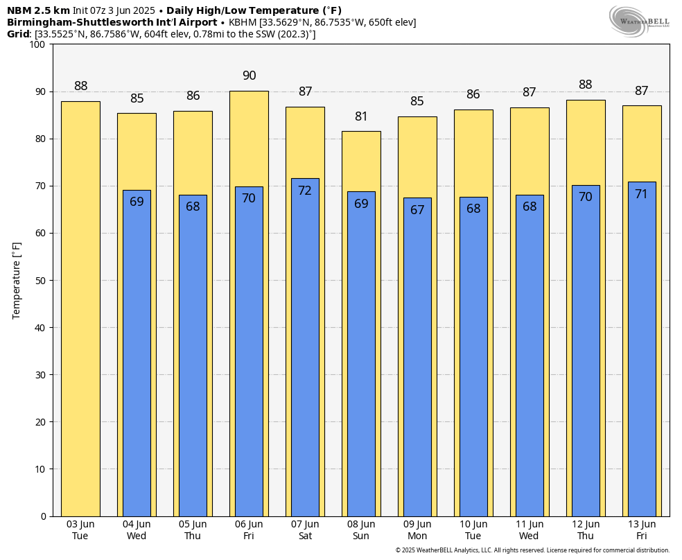
ANOTHER DRY DAY: Look for a high between 87 and 91 degrees across Alabama today with a good supply of sunshine. Moisture levels rise Wednesday, and we will introduce the chance of scattered showers and thunderstorms by afternoon. The chance of any one spot seeing rain is 30-40%, and the high will be in the mid to upper 80s.
THURSDAY/FRIDAY: Expect a partly sunny sky both days with widely scattered, mostly afternoon and evening showers and thunderstorms. Highs will remain between 84 and 90 degrees, very close to seasonal averages for early June.
THE ALABAMA WEEKEND: A surface front will bring an increase in the number of showers and thunderstorms to the northern half of the state Saturday; the Storm Prediction Center has defined a risk of severe storms there due to the potential of hail and strong, gusty winds. We will mention a chance of showers and thunderstorms statewide on Sunday — not raining all day, but a passing shower or storm is likely. Highs will be in the 80s both days.
NEXT WEEK: Models diverge a bit on weather possibilities early next week, making for a low-confidence forecast, but for now we will roll with a routine June pattern of partly sunny days with the risk of mostly afternoon and evening showers and thunderstorms in scattered spots. Highs will be in the 80s, lows in the upper 60s most mornings.
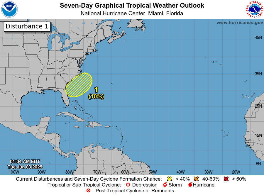
TROPICS: A nontropical area of low pressure is forecast to form near or offshore of the southeastern U.S. coast during the next two to three days. If the system remains offshore, the low could gradually develop some subtropical or tropical characteristics later this week while moving northeastward at 10 to 15 mph. The chance of development over the next seven days is only 10%. The rest of the Atlantic basin, including the Gulf, is very quiet.
ON THIS DATE IN 1860: Iowa’s infamous Camanche Tornado, likely an F5 storm, killed 92 and injured 200. Every home and business were destroyed. It was one of the most damaging families of tornadoes ever to strike the United States and resulted in more farm fatalities than any other tornado except for the Tri-State tornado.
ON THIS DATE IN 1993: Early-morning severe thunderstorms dumped huge hailstones across northern Oklahoma. Hail, up to 6 inches in diameter in Enid, went through roofs of homes and damaged three jets at Vance Air Force Base.
For more weather news and information from James Spann and his team, visit AlabamaWx.