James Spann: Windy start to the day for Alabama; a few afternoon showers

WINDY START: A wake low has developed on the back edge of the large rain mass that has been moving through overnight; gradient winds of 30-40 mph have been reported over many west Alabama counties just before daybreak. The stronger winds will last for about 30 minutes or so; a few trees could come down due to the saturated soil conditions. Widespread rain will end early this morning, but a few scattered showers are possible this afternoon and tonight. The high will be between 77 and 82 degrees, right at average levels for early May.
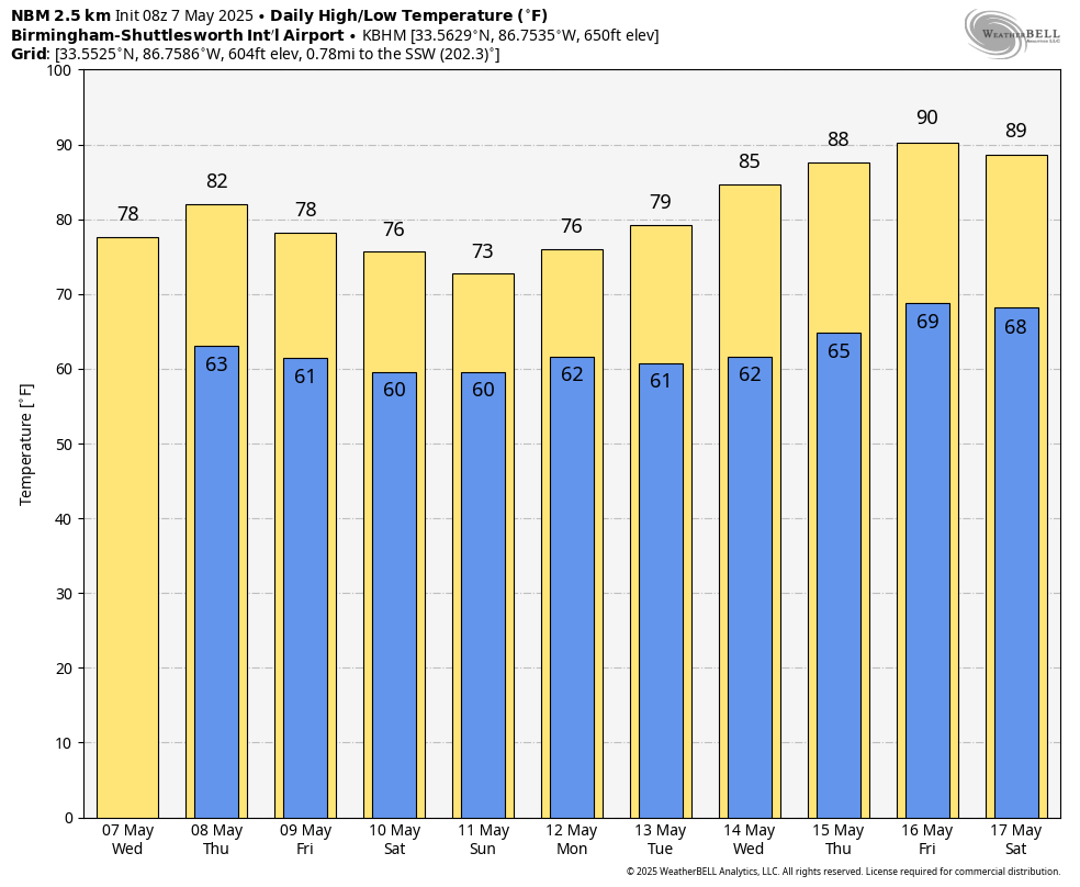
We are forecasting a mix of sun and clouds Thursday with a high in the low 80s; a few scattered showers and storms are likely, especially during the afternoon and evening.
FRIDAY AND THE WEEKEND: As the upper trough to the west slowly approaches, we expect periods of rain on all three days. It won’t be a total washout, and the sun could peek out. But if you have an outdoor event planned, be ready for some rain at times. Some thunder is possible, but we are not expecting severe thunderstorms. Highs will be in the mid to upper 70s for most places. Rain amounts between now and Sunday could exceed 4 inches over south Alabama; amounts of 1-3 inches are likely for the northern half of the state.
NEXT WEEK: We will maintain a chance of showers Monday and Tuesday, but the latter half of the week will be generally dry and much warmer. In fact, highs will be close to 90 degrees by the end of the week as an upper ridge begins to build.
ON THIS DATE IN 1993: Serious flooding occurred in central Oklahoma following torrential rain and hail on May 7-8. Rainfall amounts on this date were generally around 1 inch. Oklahoma City then recorded 6.64 inches of rain on May 8, the third-greatest daily rainfall amount ever observed in the city. Extensive flooding resulted, which killed four people, and the fire department had to rescue 183 others.
For more weather news and information from James Spann and his team, visit AlabamaWx.