Scott Martin: Potential for strong storms in Alabama through early in the week

TODAY: Strong to severe thunderstorms pushed in overnight and into daybreak. Most of that activity is winding down this morning. We expect a ragged line of storms by midmorning as the better forcing lifts north of us. The atmosphere remains unstable this afternoon, so a marginal risk for severe storms stays in place. If storms redevelop later today — depending on leftover boundaries from this morning’s storms — damaging winds and large hail will be possible.
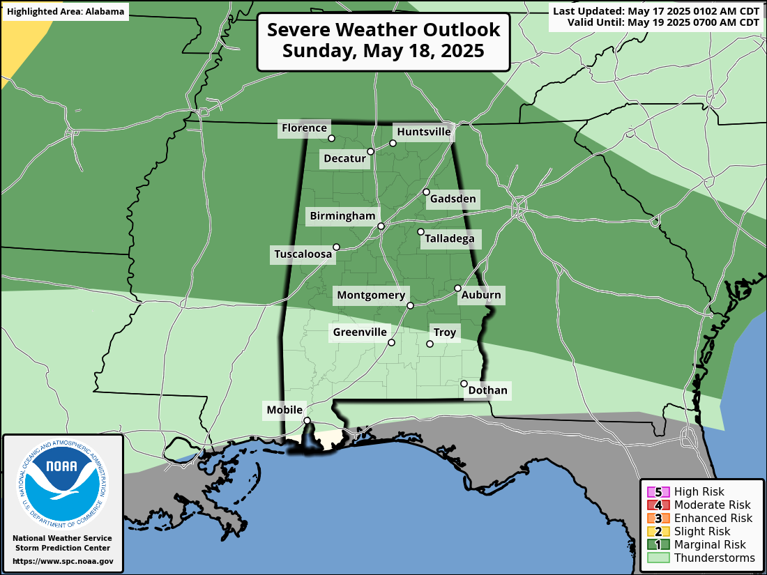
SUNDAY: Another marginal risk remains as a new round of storms pushes in. These could be a bit more organized, but it’s still uncertain. Damaging winds and hail are the main threats again. In north Alabama, lingering showers and elevated storms will lift northeastward, mainly affecting northeast Mississippi and northwest Alabama during the late morning and afternoon. Wind gusts up to 40-50 mph and small hail are possible. A second round of storms could develop Sunday night, but impacts look mainly northwest of us. Highs Sunday will stay warm, in the mid to upper 80s.
THE WORK WEEK AND BEYOND: Monday looks mostly dry with highs in the mid to upper 80s. A ridge of high pressure builds overhead. Late Monday night into Tuesday morning, some scattered storms could pop near a warm front — mostly north of us.
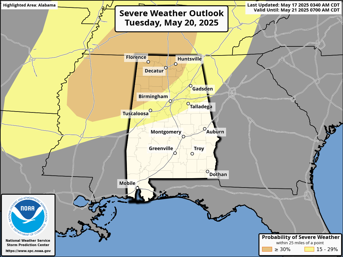
Tuesday night brings a more organized trough and cold front pushing toward the region. While the strongest forcing stays north, central Alabama can’t rule out a few strong to severe storms if the atmosphere remains unstable. Temperatures will cool behind the front Wednesday, with highs dropping into the upper 70s and low 80s.
Thursday will feel noticeably cooler and more comfortable, with highs mostly in the low to upper 70s. Expect mostly dry conditions with a refreshing change in the air thanks to the cold front settling in.
Friday will look similar to Thursday — dry, pleasant and cooler than what we’ve seen recently. Highs should stay in the 70s, making it a great day to enjoy the outdoors without the typical summer heat.
Make sure to stay weather aware through next weekend, especially if you live north of I-20, where stronger storms could linger into early Sunday. We’ll keep you updated with any changes.
For more weather news and information from James Spann, Scott Martin and other members of the James Spann team, visit AlabamaWx.