Scott Martin: Rain, storms for Alabama this weekend; summer heat returns next week

TODAY: Look for a wet and occasionally stormy Saturday. Widespread showers and thunderstorms are expected, especially in the morning and early afternoon. Some breaks in the rain are possible, but don’t count on much sunshine. Instability will be higher across north and south Alabama, and with some decent wind shear in place, a few storms could become strong. Gusty winds and small hail are possible, and while the overall severe threat is low, we’ll be watching closely. Highs will stay on the cooler side — mid 60s up north to the upper 70s down south.
MOTHER’S DAY: More rain and storms are likely Sunday, mainly during the afternoon and evening. The highest rain coverage will be across the southern and eastern counties. A few stronger storms are possible, especially in southeast Alabama. Highs will range from the lower 70s to lower 80s.
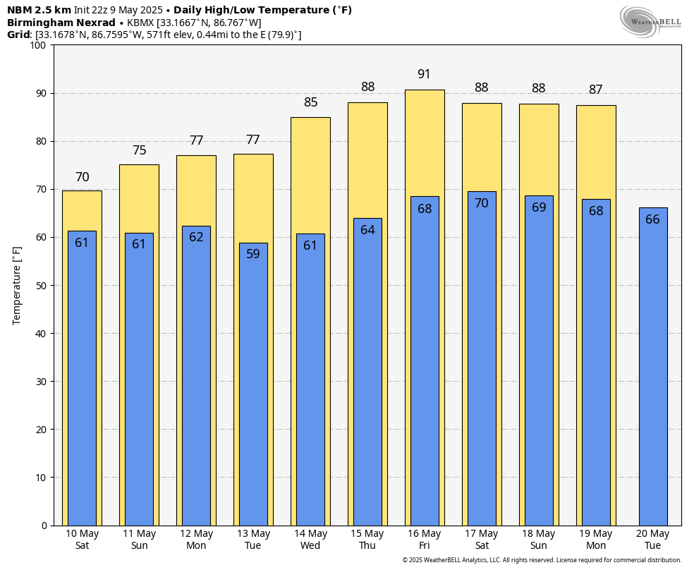
THE WORK WEEK: On Monday, the unsettled pattern holds. Expect periods of rain and thunderstorms, especially east of I-65. The southeast corner of the state could briefly get a few stronger storms. Highs will be in the lower 70s north and east to near 80 south and west. A few showers will stay around into the afternoon Tuesday, mainly in the northeast, but most of the state begins drying out. Skies should gradually clear west to east. Highs will warm into the mid 70s in the north and lower 80s in the south.
Sunshine returns Wednesday as ridging builds in. A stray shower can’t be ruled out in the far northeast, but most places stay dry. Highs will climb into the lower 80s in the northeast to near 90 in the west and south. Thursday will be a classic May day — sunny, dry and warmer. Expect highs in the mid 80s to lower 90s statewide. Friday will be hot and mostly sunny. Highs soar into the upper 80s to mid 90s as summer tries to take the wheel a bit early.
For more weather news and information from James Spann, Scott Martin and other members of the James Spann team, visit AlabamaWx.