Scott Martin: Some storms, cooler temps for Alabama this weekend

COOLER, WETTER WEEKEND: This weekend, a significant change in the weather pattern is expected to bring cooler temperatures and a higher chance of rain. On Saturday, scattered thunderstorms are likely to form mainly along and south of the Interstate 59 corridor, a major highway that runs through the state, connecting cities like Tuscaloosa, Birmingham and Gadsden. For those north of the corridor, the risk of showers is very low. High temperatures will range from the low 80s to the mid-90s. Sunday will see scattered showers and storms continue, but with a notable drop in temperatures, which will be below the seasonal average. Highs will be in the mid-70s to the upper 80s.
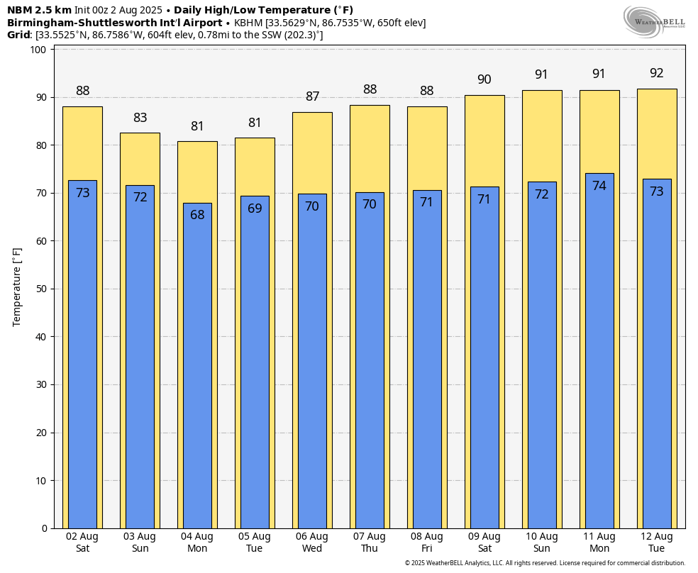
THE WORK WEEK AHEAD: The new week will start off much like the end of the weekend, with a high likelihood of rain and storms on Monday and temperatures remaining below normal, with highs in the mid-70s to mid-80s. By Tuesday, rain chances will decrease, though scattered showers and storms will still be possible in the afternoon. Highs will begin to climb slightly, reaching the upper 70s to upper 80s. The latter half of the week will see a further reduction in rain activity. Wednesday through Friday, only a few isolated showers and storms are possible, with most areas remaining dry. As the rain chances diminish, temperatures will return to a more typical summer pattern, with highs ranging from the low 80s to the low 90s on Wednesday and Thursday and climbing to the mid-80s to low 90s by Friday.
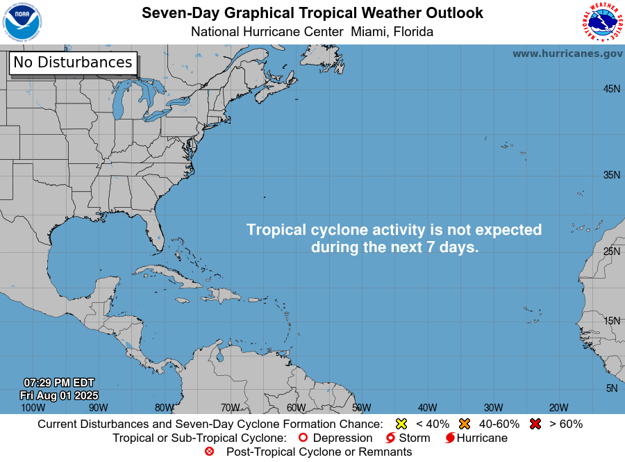
TROPICS: The quiet period for tropical weather in the Atlantic basin is expected to continue for at least the next seven days. The main development region remains calm, and no tropical cyclone development is anticipated.
For more weather news and information from James Spann, Scott Martin and other members of the James Spann team, visit AlabamaWx.